You are here: Home > Network List > TA - USArray Transportable Network (new EarthScope stations) Stations List
> Station T11A Corn Creek, Alamo, NV, USA > Earthquake Result Viewer
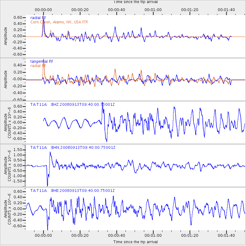
T11A Corn Creek, Alamo, NV, USA - Earthquake Result Viewer
*The percent match for this event was below the threshold and hence no stack was calculated.
| Earthquake location: |
Colombia |
| Earthquake latitude/longitude: |
4.8/-75.5 |
| Earthquake time(UTC): |
2008/09/13 (257) 09:32:01 GMT |
| Earthquake Depth: |
133 km |
| Earthquake Magnitude: |
5.9 MB, 5.7 MW, 5.7 MW |
| Earthquake Catalog/Contributor: |
WHDF/NEIC |
|
| Network: |
TA USArray Transportable Network (new EarthScope stations) |
| Station: |
T11A Corn Creek, Alamo, NV, USA |
| Lat/Lon: |
37.24 N/115.22 W |
| Elevation: |
1402 m |
|
| Distance: |
48.6 deg |
| Az: |
317.15 deg |
| Baz: |
121.872 deg |
| Ray Param: |
$rayparam |
*The percent match for this event was below the threshold and hence was not used in the summary stack. |
|
| Radial Match: |
68.15992 % |
| Radial Bump: |
400 |
| Transverse Match: |
55.17457 % |
| Transverse Bump: |
400 |
| SOD ConfigId: |
2560 |
| Insert Time: |
2010-03-07 05:00:08.719 +0000 |
| GWidth: |
2.5 |
| Max Bumps: |
400 |
| Tol: |
0.001 |
|
Signal To Noise
| Channel | StoN | STA | LTA |
| TA:T11A: :BHN:20080913T09:40:00.75001Z | 8.392786 | 7.60408E-7 | 9.060257E-8 |
| TA:T11A: :BHE:20080913T09:40:00.75001Z | 1.9834603 | 2.5398379E-7 | 1.2805086E-7 |
| TA:T11A: :BHZ:20080913T09:40:00.75001Z | 3.2490115 | 3.6383724E-7 | 1.1198398E-7 |
| Arrivals |
| Ps | |
| PpPs | |
| PsPs/PpSs | |


