You are here: Home > Network List > TA - USArray Transportable Network (new EarthScope stations) Stations List
> Station T11A Corn Creek, Alamo, NV, USA > Earthquake Result Viewer
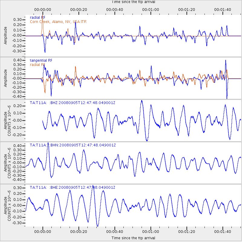
T11A Corn Creek, Alamo, NV, USA - Earthquake Result Viewer
*The percent match for this event was below the threshold and hence no stack was calculated.
| Earthquake location: |
Vanuatu Islands |
| Earthquake latitude/longitude: |
-13.3/167.0 |
| Earthquake time(UTC): |
2008/09/05 (249) 12:35:43 GMT |
| Earthquake Depth: |
147 km |
| Earthquake Magnitude: |
5.6 MW, 5.3 MB, 5.6 MW |
| Earthquake Catalog/Contributor: |
WHDF/NEIC |
|
| Network: |
TA USArray Transportable Network (new EarthScope stations) |
| Station: |
T11A Corn Creek, Alamo, NV, USA |
| Lat/Lon: |
37.24 N/115.22 W |
| Elevation: |
1402 m |
|
| Distance: |
88.5 deg |
| Az: |
51.292 deg |
| Baz: |
252.181 deg |
| Ray Param: |
$rayparam |
*The percent match for this event was below the threshold and hence was not used in the summary stack. |
|
| Radial Match: |
56.749775 % |
| Radial Bump: |
323 |
| Transverse Match: |
52.692677 % |
| Transverse Bump: |
400 |
| SOD ConfigId: |
2504 |
| Insert Time: |
2010-03-07 05:00:23.668 +0000 |
| GWidth: |
2.5 |
| Max Bumps: |
400 |
| Tol: |
0.001 |
|
Signal To Noise
| Channel | StoN | STA | LTA |
| TA:T11A: :BHN:20080905T12:47:48.049001Z | 2.5342667 | 2.2557958E-7 | 8.901177E-8 |
| TA:T11A: :BHE:20080905T12:47:48.049001Z | 0.59710884 | 8.290387E-8 | 1.3884214E-7 |
| TA:T11A: :BHZ:20080905T12:47:48.049001Z | 1.81443 | 1.1652085E-7 | 6.421899E-8 |
| Arrivals |
| Ps | |
| PpPs | |
| PsPs/PpSs | |


