You are here: Home > Network List > TA - USArray Transportable Network (new EarthScope stations) Stations List
> Station T11A Corn Creek, Alamo, NV, USA > Earthquake Result Viewer
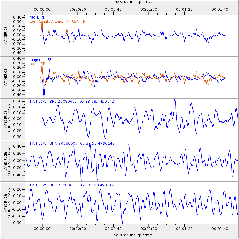
T11A Corn Creek, Alamo, NV, USA - Earthquake Result Viewer
*The percent match for this event was below the threshold and hence no stack was calculated.
| Earthquake location: |
West Chile Rise |
| Earthquake latitude/longitude: |
-38.9/-91.6 |
| Earthquake time(UTC): |
2008/06/05 (157) 05:22:26 GMT |
| Earthquake Depth: |
7.0 km |
| Earthquake Magnitude: |
5.5 MS, 5.3 MB, 5.8 MW, 5.8 MW |
| Earthquake Catalog/Contributor: |
WHDF/NEIC |
|
| Network: |
TA USArray Transportable Network (new EarthScope stations) |
| Station: |
T11A Corn Creek, Alamo, NV, USA |
| Lat/Lon: |
37.24 N/115.22 W |
| Elevation: |
1402 m |
|
| Distance: |
78.8 deg |
| Az: |
340.986 deg |
| Baz: |
161.417 deg |
| Ray Param: |
$rayparam |
*The percent match for this event was below the threshold and hence was not used in the summary stack. |
|
| Radial Match: |
65.9818 % |
| Radial Bump: |
302 |
| Transverse Match: |
69.049934 % |
| Transverse Bump: |
400 |
| SOD ConfigId: |
2504 |
| Insert Time: |
2010-03-07 05:00:26.580 +0000 |
| GWidth: |
2.5 |
| Max Bumps: |
400 |
| Tol: |
0.001 |
|
Signal To Noise
| Channel | StoN | STA | LTA |
| TA:T11A: :BHN:20080605T05:33:58.449014Z | 1.737471 | 1.9593169E-7 | 1.12768326E-7 |
| TA:T11A: :BHE:20080605T05:33:58.449014Z | 1.3680965 | 1.3792841E-7 | 1.0081776E-7 |
| TA:T11A: :BHZ:20080605T05:33:58.449014Z | 1.1046386 | 1.12872435E-7 | 1.0218042E-7 |
| Arrivals |
| Ps | |
| PpPs | |
| PsPs/PpSs | |


