You are here: Home > Network List > IW - Intermountain West Stations List
> Station DLMT Dillon, Montana, USA > Earthquake Result Viewer
DLMT Dillon, Montana, USA - Earthquake Result Viewer
*The percent match for this event was below the threshold and hence no stack was calculated.
| Earthquake location: |
Kuril Islands |
| Earthquake latitude/longitude: |
44.6/146.7 |
| Earthquake time(UTC): |
2019/10/14 (287) 23:14:51 GMT |
| Earthquake Depth: |
93 km |
| Earthquake Magnitude: |
5.7 mb |
| Earthquake Catalog/Contributor: |
NEIC PDE/us |
|
| Network: |
IW Intermountain West |
| Station: |
DLMT Dillon, Montana, USA |
| Lat/Lon: |
45.36 N/112.60 W |
| Elevation: |
1569 m |
|
| Distance: |
66.2 deg |
| Az: |
49.189 deg |
| Baz: |
309.942 deg |
| Ray Param: |
$rayparam |
*The percent match for this event was below the threshold and hence was not used in the summary stack. |
|
| Radial Match: |
56.570724 % |
| Radial Bump: |
400 |
| Transverse Match: |
56.110306 % |
| Transverse Bump: |
400 |
| SOD ConfigId: |
19951751 |
| Insert Time: |
2019-10-28 23:22:28.602 +0000 |
| GWidth: |
2.5 |
| Max Bumps: |
400 |
| Tol: |
0.001 |
|
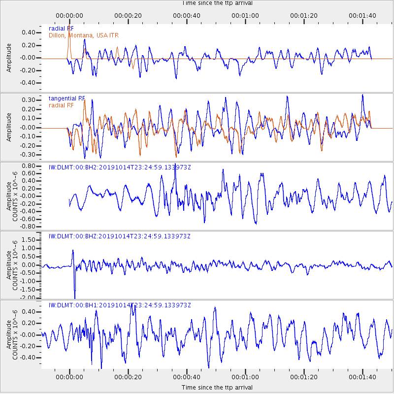
Signal To Noise
| Channel | StoN | STA | LTA |
| IW:DLMT:00:BHZ:20191014T23:24:59.133973Z | 4.4821467 | 5.594154E-7 | 1.2480972E-7 |
| IW:DLMT:00:BH1:20191014T23:24:59.133973Z | 0.68480605 | 1.1701593E-7 | 1.7087456E-7 |
| IW:DLMT:00:BH2:20191014T23:24:59.133973Z | 2.1274917 | 3.4386264E-7 | 1.616282E-7 |
| Arrivals |
| Ps | |
| PpPs | |
| PsPs/PpSs | |


