You are here: Home > Network List > TA - USArray Transportable Network (new EarthScope stations) Stations List
> Station K13K Kusilvak Mountain, AK, USA > Earthquake Result Viewer
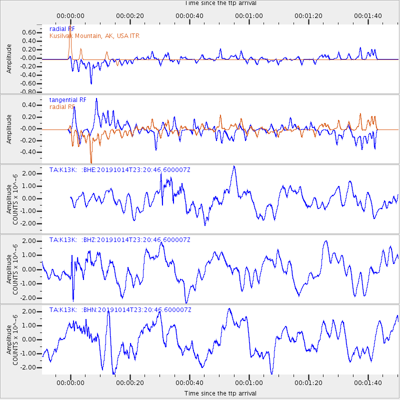
K13K Kusilvak Mountain, AK, USA - Earthquake Result Viewer
*The percent match for this event was below the threshold and hence no stack was calculated.
| Earthquake location: |
Kuril Islands |
| Earthquake latitude/longitude: |
44.6/146.7 |
| Earthquake time(UTC): |
2019/10/14 (287) 23:14:51 GMT |
| Earthquake Depth: |
93 km |
| Earthquake Magnitude: |
5.7 mb |
| Earthquake Catalog/Contributor: |
NEIC PDE/us |
|
| Network: |
TA USArray Transportable Network (new EarthScope stations) |
| Station: |
K13K Kusilvak Mountain, AK, USA |
| Lat/Lon: |
61.93 N/164.66 W |
| Elevation: |
204 m |
|
| Distance: |
32.9 deg |
| Az: |
40.856 deg |
| Baz: |
261.027 deg |
| Ray Param: |
$rayparam |
*The percent match for this event was below the threshold and hence was not used in the summary stack. |
|
| Radial Match: |
78.174614 % |
| Radial Bump: |
400 |
| Transverse Match: |
68.06819 % |
| Transverse Bump: |
400 |
| SOD ConfigId: |
19951751 |
| Insert Time: |
2019-10-28 23:25:57.566 +0000 |
| GWidth: |
2.5 |
| Max Bumps: |
400 |
| Tol: |
0.001 |
|
Signal To Noise
| Channel | StoN | STA | LTA |
| TA:K13K: :BHZ:20191014T23:20:46.600007Z | 1.092117 | 6.8831054E-7 | 6.302535E-7 |
| TA:K13K: :BHN:20191014T23:20:46.600007Z | 1.3643539 | 1.15631E-6 | 8.475147E-7 |
| TA:K13K: :BHE:20191014T23:20:46.600007Z | 2.1734595 | 1.2515208E-6 | 5.758197E-7 |
| Arrivals |
| Ps | |
| PpPs | |
| PsPs/PpSs | |


