You are here: Home > Network List > US - United States National Seismic Network Stations List
> Station WMOK Wichita Mountains, Oklahoma, USA > Earthquake Result Viewer
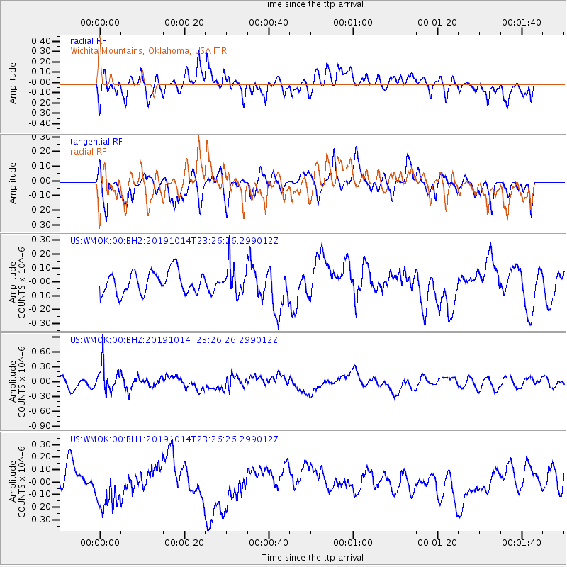
WMOK Wichita Mountains, Oklahoma, USA - Earthquake Result Viewer
*The percent match for this event was below the threshold and hence no stack was calculated.
| Earthquake location: |
Kuril Islands |
| Earthquake latitude/longitude: |
44.6/146.7 |
| Earthquake time(UTC): |
2019/10/14 (287) 23:14:51 GMT |
| Earthquake Depth: |
93 km |
| Earthquake Magnitude: |
5.7 mb |
| Earthquake Catalog/Contributor: |
NEIC PDE/us |
|
| Network: |
US United States National Seismic Network |
| Station: |
WMOK Wichita Mountains, Oklahoma, USA |
| Lat/Lon: |
34.74 N/98.78 W |
| Elevation: |
486 m |
|
| Distance: |
81.2 deg |
| Az: |
49.304 deg |
| Baz: |
318.893 deg |
| Ray Param: |
$rayparam |
*The percent match for this event was below the threshold and hence was not used in the summary stack. |
|
| Radial Match: |
49.340164 % |
| Radial Bump: |
400 |
| Transverse Match: |
58.465378 % |
| Transverse Bump: |
400 |
| SOD ConfigId: |
19951751 |
| Insert Time: |
2019-10-28 23:27:16.714 +0000 |
| GWidth: |
2.5 |
| Max Bumps: |
400 |
| Tol: |
0.001 |
|
Signal To Noise
| Channel | StoN | STA | LTA |
| US:WMOK:00:BHZ:20191014T23:26:26.299012Z | 2.2651134 | 2.7045414E-7 | 1.1939983E-7 |
| US:WMOK:00:BH1:20191014T23:26:26.299012Z | 1.6202201 | 1.7911248E-7 | 1.10548235E-7 |
| US:WMOK:00:BH2:20191014T23:26:26.299012Z | 1.2874199 | 1.0057454E-7 | 7.8121005E-8 |
| Arrivals |
| Ps | |
| PpPs | |
| PsPs/PpSs | |


