You are here: Home > Network List > UW - Pacific Northwest Regional Seismic Network Stations List
> Station LEBA Lebam, WA, USA > Earthquake Result Viewer
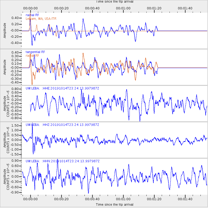
LEBA Lebam, WA, USA - Earthquake Result Viewer
*The percent match for this event was below the threshold and hence no stack was calculated.
| Earthquake location: |
Kuril Islands |
| Earthquake latitude/longitude: |
44.6/146.7 |
| Earthquake time(UTC): |
2019/10/14 (287) 23:14:51 GMT |
| Earthquake Depth: |
93 km |
| Earthquake Magnitude: |
5.7 mb |
| Earthquake Catalog/Contributor: |
NEIC PDE/us |
|
| Network: |
UW Pacific Northwest Regional Seismic Network |
| Station: |
LEBA Lebam, WA, USA |
| Lat/Lon: |
46.55 N/123.56 W |
| Elevation: |
73 m |
|
| Distance: |
59.4 deg |
| Az: |
53.292 deg |
| Baz: |
303.95 deg |
| Ray Param: |
$rayparam |
*The percent match for this event was below the threshold and hence was not used in the summary stack. |
|
| Radial Match: |
51.42828 % |
| Radial Bump: |
400 |
| Transverse Match: |
50.793285 % |
| Transverse Bump: |
400 |
| SOD ConfigId: |
19951751 |
| Insert Time: |
2019-10-28 23:27:43.143 +0000 |
| GWidth: |
2.5 |
| Max Bumps: |
400 |
| Tol: |
0.001 |
|
Signal To Noise
| Channel | StoN | STA | LTA |
| UW:LEBA: :HHZ:20191014T23:24:13.997987Z | 2.632368 | 6.362839E-7 | 2.417154E-7 |
| UW:LEBA: :HHN:20191014T23:24:13.997987Z | 1.5768803 | 3.9652846E-7 | 2.514639E-7 |
| UW:LEBA: :HHE:20191014T23:24:13.997987Z | 1.2859908 | 3.5121596E-7 | 2.7310924E-7 |
| Arrivals |
| Ps | |
| PpPs | |
| PsPs/PpSs | |


