You are here: Home > Network List > US - United States National Seismic Network Stations List
> Station EGMT Eagleton, Montana, USA > Earthquake Result Viewer
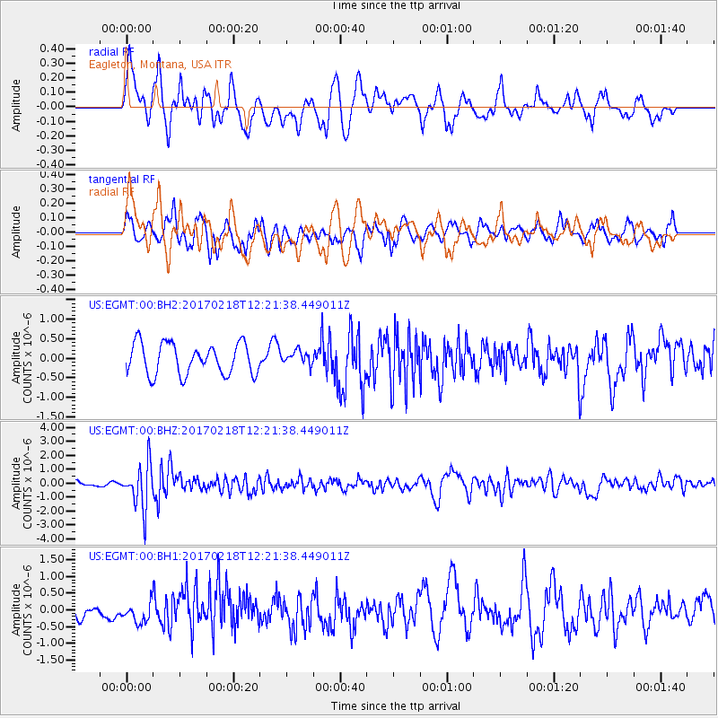
EGMT Eagleton, Montana, USA - Earthquake Result Viewer
*The percent match for this event was below the threshold and hence no stack was calculated.
| Earthquake location: |
Jujuy Province, Argentina |
| Earthquake latitude/longitude: |
-23.9/-66.7 |
| Earthquake time(UTC): |
2017/02/18 (049) 12:10:15 GMT |
| Earthquake Depth: |
201 km |
| Earthquake Magnitude: |
6.3 Mww |
| Earthquake Catalog/Contributor: |
NEIC PDE/us |
|
| Network: |
US United States National Seismic Network |
| Station: |
EGMT Eagleton, Montana, USA |
| Lat/Lon: |
48.02 N/109.75 W |
| Elevation: |
1055 m |
|
| Distance: |
81.4 deg |
| Az: |
332.378 deg |
| Baz: |
140.8 deg |
| Ray Param: |
$rayparam |
*The percent match for this event was below the threshold and hence was not used in the summary stack. |
|
| Radial Match: |
60.88473 % |
| Radial Bump: |
400 |
| Transverse Match: |
65.37113 % |
| Transverse Bump: |
400 |
| SOD ConfigId: |
1992691 |
| Insert Time: |
2017-03-04 12:17:05.008 +0000 |
| GWidth: |
2.5 |
| Max Bumps: |
400 |
| Tol: |
0.001 |
|
Signal To Noise
| Channel | StoN | STA | LTA |
| US:EGMT:00:BHZ:20170218T12:21:38.449011Z | 5.106064 | 1.6044689E-6 | 3.1422815E-7 |
| US:EGMT:00:BH1:20170218T12:21:38.449011Z | 1.2645932 | 3.0049398E-7 | 2.3762105E-7 |
| US:EGMT:00:BH2:20170218T12:21:38.449011Z | 0.4374553 | 1.728569E-7 | 3.9514185E-7 |
| Arrivals |
| Ps | |
| PpPs | |
| PsPs/PpSs | |


