You are here: Home > Network List > US - United States National Seismic Network Stations List
> Station HDIL Hopedale, Illinois, USA > Earthquake Result Viewer
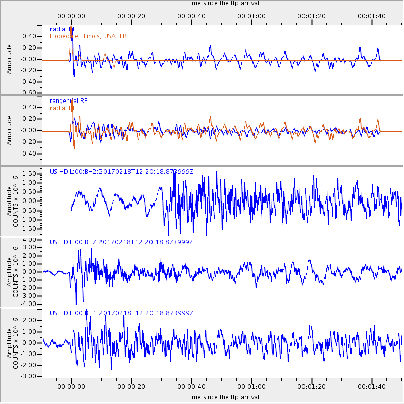
HDIL Hopedale, Illinois, USA - Earthquake Result Viewer
*The percent match for this event was below the threshold and hence no stack was calculated.
| Earthquake location: |
Jujuy Province, Argentina |
| Earthquake latitude/longitude: |
-23.9/-66.7 |
| Earthquake time(UTC): |
2017/02/18 (049) 12:10:15 GMT |
| Earthquake Depth: |
201 km |
| Earthquake Magnitude: |
6.3 Mww |
| Earthquake Catalog/Contributor: |
NEIC PDE/us |
|
| Network: |
US United States National Seismic Network |
| Station: |
HDIL Hopedale, Illinois, USA |
| Lat/Lon: |
40.56 N/89.29 W |
| Elevation: |
219 m |
|
| Distance: |
67.5 deg |
| Az: |
341.519 deg |
| Baz: |
157.622 deg |
| Ray Param: |
$rayparam |
*The percent match for this event was below the threshold and hence was not used in the summary stack. |
|
| Radial Match: |
59.365776 % |
| Radial Bump: |
400 |
| Transverse Match: |
65.7665 % |
| Transverse Bump: |
400 |
| SOD ConfigId: |
1992691 |
| Insert Time: |
2017-03-04 12:17:15.315 +0000 |
| GWidth: |
2.5 |
| Max Bumps: |
400 |
| Tol: |
0.001 |
|
Signal To Noise
| Channel | StoN | STA | LTA |
| US:HDIL:00:BHZ:20170218T12:20:18.873999Z | 6.404543 | 1.6049107E-6 | 2.505894E-7 |
| US:HDIL:00:BH1:20170218T12:20:18.873999Z | 2.1148186 | 9.64932E-7 | 4.5627175E-7 |
| US:HDIL:00:BH2:20170218T12:20:18.873999Z | 2.4945967 | 7.84253E-7 | 3.1438069E-7 |
| Arrivals |
| Ps | |
| PpPs | |
| PsPs/PpSs | |


