U17A Shonto, AZ, USA - Earthquake Result Viewer
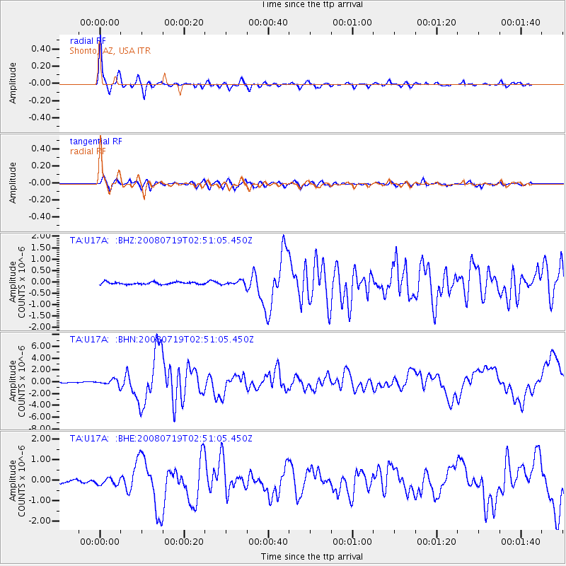
Earthquake location: Off East Coast Of Honshu, Japan
Earthquake latitude/longitude: 37.6/142.2
Earthquake time(UTC): 2008/07/19 (201) 02:39:28 GMT
Earthquake Depth: 22 km
Earthquake Magnitude: 6.2 MB, 7.0 MS, 7.0 MW, 6.9 MW
Earthquake Catalog/Contributor: WHDF/NEIC
Network: TA USArray Transportable Network (new EarthScope stations)
Station: U17A Shonto, AZ, USA
Lat/Lon: 36.60 N/110.66 W
Elevation: 1976 m
Distance: 80.1 deg
Az: 51.324 deg
Baz: 309.554 deg
Ray Param: 0.048486892
Estimated Moho Depth: 44.0 km
Estimated Crust Vp/Vs: 1.65
Assumed Crust Vp: 6.247 km/s
Estimated Crust Vs: 3.774 km/s
Estimated Crust Poisson's Ratio: 0.21
Radial Match: 97.64438 %
Radial Bump: 296
Transverse Match: 86.77287 %
Transverse Bump: 400
SOD ConfigId: 2504
Insert Time: 2010-03-07 05:02:50.523 +0000
GWidth: 2.5
Max Bumps: 400
Tol: 0.001

Signal To Noise

ChannelStoNSTALTA
TA:U17A: :BHN:20080719T02:51:05.450Z7.03384.835573E-76.874766E-8
TA:U17A: :BHE:20080719T02:51:05.450Z2.334641.5184905E-76.504174E-8
TA:U17A: :BHZ:20080719T02:51:05.450Z2.02695731.0033542E-74.950051E-8
Arrivals
Ps4.7 SECOND
PpPs18 SECOND
PsPs/PpSs23 SECOND