You are here: Home > Network List > TA - USArray Transportable Network (new EarthScope stations) Stations List
> Station D25K Kavik River, AK, USA > Earthquake Result Viewer
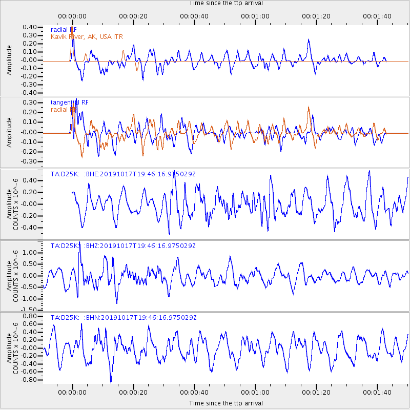
D25K Kavik River, AK, USA - Earthquake Result Viewer
*The percent match for this event was below the threshold and hence no stack was calculated.
| Earthquake location: |
Near N Coast Of New Guinea, P.N.G. |
| Earthquake latitude/longitude: |
-2.9/141.6 |
| Earthquake time(UTC): |
2019/10/17 (290) 19:34:07 GMT |
| Earthquake Depth: |
18 km |
| Earthquake Magnitude: |
5.5 Mww |
| Earthquake Catalog/Contributor: |
NEIC PDE/us |
|
| Network: |
TA USArray Transportable Network (new EarthScope stations) |
| Station: |
D25K Kavik River, AK, USA |
| Lat/Lon: |
69.32 N/146.38 W |
| Elevation: |
770 m |
|
| Distance: |
86.4 deg |
| Az: |
19.783 deg |
| Baz: |
252.116 deg |
| Ray Param: |
$rayparam |
*The percent match for this event was below the threshold and hence was not used in the summary stack. |
|
| Radial Match: |
61.093082 % |
| Radial Bump: |
400 |
| Transverse Match: |
71.67294 % |
| Transverse Bump: |
400 |
| SOD ConfigId: |
19951751 |
| Insert Time: |
2019-10-31 19:46:42.913 +0000 |
| GWidth: |
2.5 |
| Max Bumps: |
400 |
| Tol: |
0.001 |
|
Signal To Noise
| Channel | StoN | STA | LTA |
| TA:D25K: :BHZ:20191017T19:46:16.975029Z | 2.7656288 | 5.460856E-7 | 1.9745441E-7 |
| TA:D25K: :BHN:20191017T19:46:16.975029Z | 1.1453838 | 2.4930023E-7 | 2.176565E-7 |
| TA:D25K: :BHE:20191017T19:46:16.975029Z | 1.5771302 | 2.7612606E-7 | 1.7508133E-7 |
| Arrivals |
| Ps | |
| PpPs | |
| PsPs/PpSs | |


