You are here: Home > Network List > TA - USArray Transportable Network (new EarthScope stations) Stations List
> Station F21K Alatna River, AK, USA > Earthquake Result Viewer
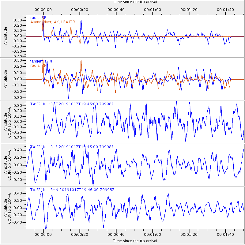
F21K Alatna River, AK, USA - Earthquake Result Viewer
*The percent match for this event was below the threshold and hence no stack was calculated.
| Earthquake location: |
Near N Coast Of New Guinea, P.N.G. |
| Earthquake latitude/longitude: |
-2.9/141.6 |
| Earthquake time(UTC): |
2019/10/17 (290) 19:34:07 GMT |
| Earthquake Depth: |
18 km |
| Earthquake Magnitude: |
5.5 Mww |
| Earthquake Catalog/Contributor: |
NEIC PDE/us |
|
| Network: |
TA USArray Transportable Network (new EarthScope stations) |
| Station: |
F21K Alatna River, AK, USA |
| Lat/Lon: |
67.22 N/153.48 W |
| Elevation: |
597 m |
|
| Distance: |
83.2 deg |
| Az: |
20.798 deg |
| Baz: |
245.609 deg |
| Ray Param: |
$rayparam |
*The percent match for this event was below the threshold and hence was not used in the summary stack. |
|
| Radial Match: |
60.061718 % |
| Radial Bump: |
400 |
| Transverse Match: |
62.1225 % |
| Transverse Bump: |
400 |
| SOD ConfigId: |
19951751 |
| Insert Time: |
2019-10-31 19:46:50.294 +0000 |
| GWidth: |
2.5 |
| Max Bumps: |
400 |
| Tol: |
0.001 |
|
Signal To Noise
| Channel | StoN | STA | LTA |
| TA:F21K: :BHZ:20191017T19:46:00.79998Z | 1.2671269 | 2.532324E-7 | 1.9984769E-7 |
| TA:F21K: :BHN:20191017T19:46:00.79998Z | 2.3319218 | 3.5115056E-7 | 1.5058419E-7 |
| TA:F21K: :BHE:20191017T19:46:00.79998Z | 1.0136945 | 1.3706006E-7 | 1.3520844E-7 |
| Arrivals |
| Ps | |
| PpPs | |
| PsPs/PpSs | |


