You are here: Home > Network List > US - United States National Seismic Network Stations List
> Station WMOK Wichita Mountains, Oklahoma, USA > Earthquake Result Viewer
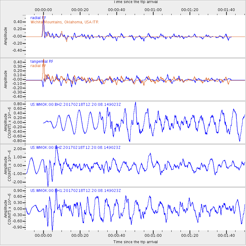
WMOK Wichita Mountains, Oklahoma, USA - Earthquake Result Viewer
*The percent match for this event was below the threshold and hence no stack was calculated.
| Earthquake location: |
Jujuy Province, Argentina |
| Earthquake latitude/longitude: |
-23.9/-66.7 |
| Earthquake time(UTC): |
2017/02/18 (049) 12:10:15 GMT |
| Earthquake Depth: |
201 km |
| Earthquake Magnitude: |
6.3 Mww |
| Earthquake Catalog/Contributor: |
NEIC PDE/us |
|
| Network: |
US United States National Seismic Network |
| Station: |
WMOK Wichita Mountains, Oklahoma, USA |
| Lat/Lon: |
34.74 N/98.78 W |
| Elevation: |
486 m |
|
| Distance: |
65.8 deg |
| Az: |
331.336 deg |
| Baz: |
147.792 deg |
| Ray Param: |
$rayparam |
*The percent match for this event was below the threshold and hence was not used in the summary stack. |
|
| Radial Match: |
61.784554 % |
| Radial Bump: |
394 |
| Transverse Match: |
60.03251 % |
| Transverse Bump: |
399 |
| SOD ConfigId: |
1992691 |
| Insert Time: |
2017-03-04 12:17:58.819 +0000 |
| GWidth: |
2.5 |
| Max Bumps: |
400 |
| Tol: |
0.001 |
|
Signal To Noise
| Channel | StoN | STA | LTA |
| US:WMOK:00:BHZ:20170218T12:20:08.149023Z | 2.5133753 | 1.0631214E-6 | 4.2298555E-7 |
| US:WMOK:00:BH1:20170218T12:20:08.149023Z | 2.1855488 | 4.063078E-7 | 1.8590654E-7 |
| US:WMOK:00:BH2:20170218T12:20:08.149023Z | 1.0882163 | 2.8398196E-7 | 2.6096095E-7 |
| Arrivals |
| Ps | |
| PpPs | |
| PsPs/PpSs | |


