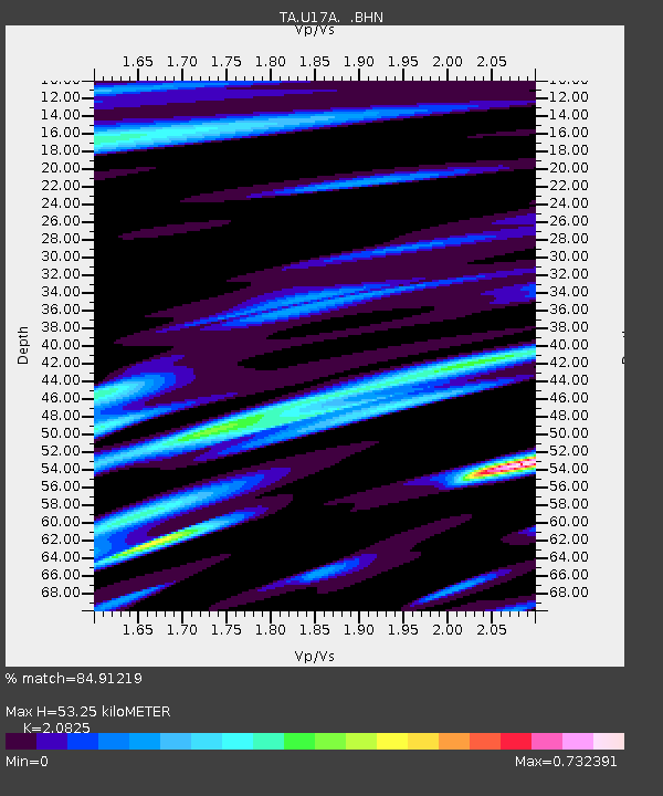
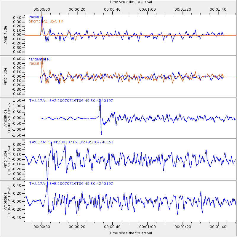
U17A Shonto, AZ, USA - Earthquake Result Viewer

Earthquake location: Near West Coast Of Honshu, Japan
Earthquake latitude/longitude: 37.5/138.5
Earthquake time(UTC): 2007/07/16 (197) 06:37:40 GMT
Earthquake Depth: 15 km
Earthquake Magnitude: 5.7 MB, 5.1 MS, 5.7 MW, 5.6 MW
Earthquake Catalog/Contributor: WHDF/NEIC
Network: TA USArray Transportable Network (new EarthScope stations)
Station: U17A Shonto, AZ, USA
Lat/Lon: 36.60 N/110.66 W
Elevation: 1976 m
Distance: 82.4 deg
Az: 49.337 deg
Baz: 311.439 deg
Ray Param: 0.046888884
Estimated Moho Depth: 53.25 km
Estimated Crust Vp/Vs: 2.08
Assumed Crust Vp: 6.247 km/s
Estimated Crust Vs: 3.0 km/s
Estimated Crust Poisson's Ratio: 0.35
Radial Match: 84.91219 %
Radial Bump: 390
Transverse Match: 65.96478 %
Transverse Bump: 400
SOD ConfigId: 2564
Insert Time: 2010-03-07 05:03:45.933 +0000
GWidth: 2.5
Max Bumps: 400
Tol: 0.001

Signal To Noise

ChannelStoNSTALTA
TA:U17A: :BHN:20070716T06:49:30.424019Z3.47048851.4358328E-74.137264E-8
TA:U17A: :BHE:20070716T06:49:30.424019Z4.3499642.099715E-74.8269712E-8
TA:U17A: :BHZ:20070716T06:49:30.424019Z9.7905736.001103E-76.1294706E-8
Arrivals
Ps9.4 SECOND
PpPs26 SECOND
PsPs/PpSs35 SECOND