
U17A Shonto, AZ, USA - Earthquake Result Viewer
| ||||||||||||||||||
| ||||||||||||||||||
| ||||||||||||||||||
|
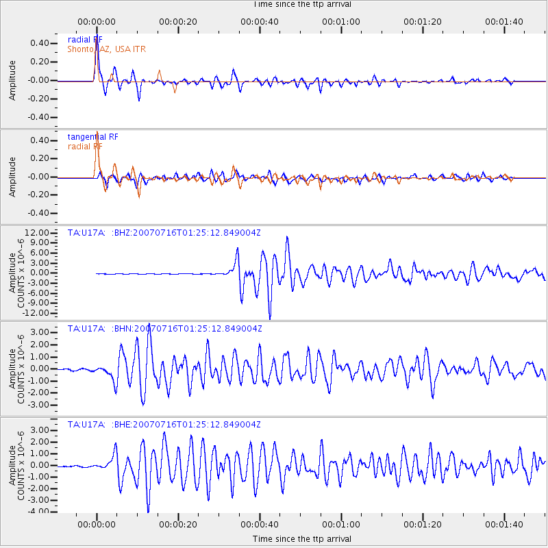
Signal To Noise
| Channel | StoN | STA | LTA |
| TA:U17A: :BHN:20070716T01:25:12.849004Z | 15.364286 | 6.45532E-7 | 4.2015095E-8 |
| TA:U17A: :BHE:20070716T01:25:12.849004Z | 10.265136 | 6.823899E-7 | 6.647646E-8 |
| TA:U17A: :BHZ:20070716T01:25:12.849004Z | 32.819828 | 2.5652907E-6 | 7.816283E-8 |
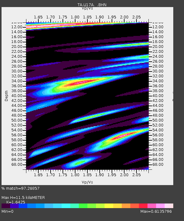
| Arrivals | |
| Ps | 1.2 SECOND |
| PpPs | 4.7 SECOND |
| PsPs/PpSs | 6.0 SECOND |

