You are here: Home > Network List > UU - University of Utah Regional Network Stations List
> Station CCUT Cedar City, UT, USA > Earthquake Result Viewer
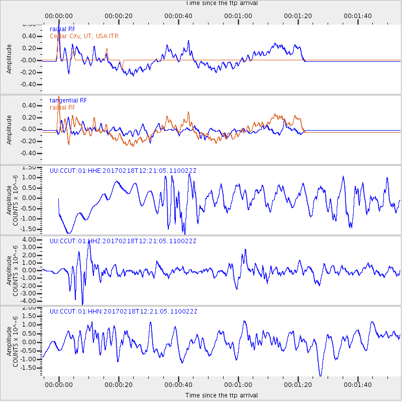
CCUT Cedar City, UT, USA - Earthquake Result Viewer
*The percent match for this event was below the threshold and hence no stack was calculated.
| Earthquake location: |
Jujuy Province, Argentina |
| Earthquake latitude/longitude: |
-23.9/-66.7 |
| Earthquake time(UTC): |
2017/02/18 (049) 12:10:15 GMT |
| Earthquake Depth: |
201 km |
| Earthquake Magnitude: |
6.3 Mww |
| Earthquake Catalog/Contributor: |
NEIC PDE/us |
|
| Network: |
UU University of Utah Regional Network |
| Station: |
CCUT Cedar City, UT, USA |
| Lat/Lon: |
37.55 N/113.36 W |
| Elevation: |
2127 m |
|
| Distance: |
75.3 deg |
| Az: |
323.284 deg |
| Baz: |
136.5 deg |
| Ray Param: |
$rayparam |
*The percent match for this event was below the threshold and hence was not used in the summary stack. |
|
| Radial Match: |
38.80266 % |
| Radial Bump: |
400 |
| Transverse Match: |
57.708427 % |
| Transverse Bump: |
372 |
| SOD ConfigId: |
1992691 |
| Insert Time: |
2017-03-04 12:18:09.059 +0000 |
| GWidth: |
2.5 |
| Max Bumps: |
400 |
| Tol: |
0.001 |
|
Signal To Noise
| Channel | StoN | STA | LTA |
| UU:CCUT:01:HHZ:20170218T12:21:05.110022Z | 2.803877 | 8.267689E-7 | 2.948663E-7 |
| UU:CCUT:01:HHN:20170218T12:21:05.110022Z | 0.48382995 | 5.5081233E-7 | 1.138442E-6 |
| UU:CCUT:01:HHE:20170218T12:21:05.110022Z | 0.636327 | 4.6888033E-7 | 7.368543E-7 |
| Arrivals |
| Ps | |
| PpPs | |
| PsPs/PpSs | |


