U17A Shonto, AZ, USA - Earthquake Result Viewer
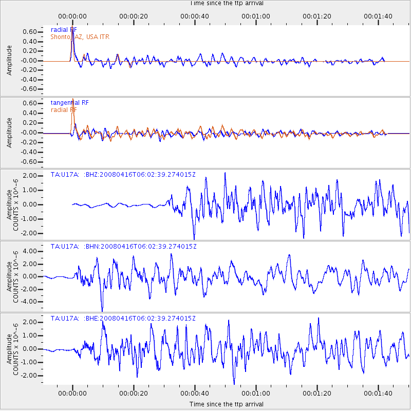
Earthquake location: Andreanof Islands, Aleutian Is.
Earthquake latitude/longitude: 51.9/-179.2
Earthquake time(UTC): 2008/04/16 (107) 05:54:19 GMT
Earthquake Depth: 13 km
Earthquake Magnitude: 6.1 MB, 6.5 MS, 6.6 MW, 6.6 MW
Earthquake Catalog/Contributor: WHDF/NEIC
Network: TA USArray Transportable Network (new EarthScope stations)
Station: U17A Shonto, AZ, USA
Lat/Lon: 36.60 N/110.66 W
Elevation: 1976 m
Distance: 49.6 deg
Az: 79.661 deg
Baz: 310.728 deg
Ray Param: 0.06861409
Estimated Moho Depth: 34.0 km
Estimated Crust Vp/Vs: 1.84
Assumed Crust Vp: 6.247 km/s
Estimated Crust Vs: 3.404 km/s
Estimated Crust Poisson's Ratio: 0.29
Radial Match: 89.10283 %
Radial Bump: 400
Transverse Match: 78.55332 %
Transverse Bump: 400
SOD ConfigId: 2504
Insert Time: 2010-03-07 05:04:14.288 +0000
GWidth: 2.5
Max Bumps: 400
Tol: 0.001

Signal To Noise

ChannelStoNSTALTA
TA:U17A: :BHN:20080416T06:02:39.274015Z5.8180526.8050645E-71.1696465E-7
TA:U17A: :BHE:20080416T06:02:39.274015Z2.85358622.5138044E-78.809282E-8
TA:U17A: :BHZ:20080416T06:02:39.274015Z3.54225752.813988E-77.9440525E-8
Arrivals
Ps4.8 SECOND
PpPs15 SECOND
PsPs/PpSs19 SECOND