
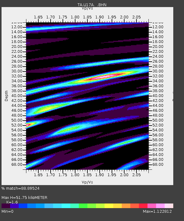
U17A Shonto, AZ, USA - Earthquake Result Viewer
| ||||||||||||||||||
| ||||||||||||||||||
| ||||||||||||||||||
|
Signal To Noise
| Channel | StoN | STA | LTA |
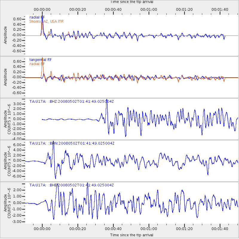
| TA:U17A: :BHN:20080502T01:41:49.025004Z | 8.377706 | 1.2318357E-6 | 1.4703735E-7 |
| TA:U17A: :BHE:20080502T01:41:49.025004Z | 4.2154326 | 5.975028E-7 | 1.4174174E-7 |
| TA:U17A: :BHZ:20080502T01:41:49.025004Z | 6.7630944 | 4.2623165E-7 | 6.302317E-8 |
| Arrivals | |
| Ps | 5.3 SECOND |
| PpPs | 20 SECOND |
| PsPs/PpSs | 26 SECOND |

