You are here: Home > Network List > CN - Canadian National Seismograph Network Stations List
> Station INK INUVIK, NT > Earthquake Result Viewer
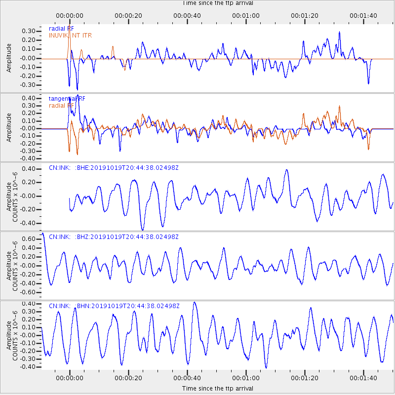
INK INUVIK, NT - Earthquake Result Viewer
*The percent match for this event was below the threshold and hence no stack was calculated.
| Earthquake location: |
Fiji Islands |
| Earthquake latitude/longitude: |
-18.9/178.1 |
| Earthquake time(UTC): |
2019/10/19 (292) 20:31:56 GMT |
| Earthquake Depth: |
37 km |
| Earthquake Magnitude: |
5.7 Mww |
| Earthquake Catalog/Contributor: |
NEIC PDE/us |
|
| Network: |
CN Canadian National Seismograph Network |
| Station: |
INK INUVIK, NT |
| Lat/Lon: |
68.31 N/133.53 W |
| Elevation: |
44 m |
|
| Distance: |
93.7 deg |
| Az: |
16.175 deg |
| Baz: |
225.19 deg |
| Ray Param: |
$rayparam |
*The percent match for this event was below the threshold and hence was not used in the summary stack. |
|
| Radial Match: |
56.41895 % |
| Radial Bump: |
400 |
| Transverse Match: |
66.341705 % |
| Transverse Bump: |
400 |
| SOD ConfigId: |
19951751 |
| Insert Time: |
2019-11-02 20:38:43.571 +0000 |
| GWidth: |
2.5 |
| Max Bumps: |
400 |
| Tol: |
0.001 |
|
Signal To Noise
| Channel | StoN | STA | LTA |
| CN:INK: :BHZ:20191019T20:44:38.02498Z | 0.48865518 | 1.7820096E-7 | 3.646763E-7 |
| CN:INK: :BHN:20191019T20:44:38.02498Z | 1.3164324 | 2.6258735E-7 | 1.9946893E-7 |
| CN:INK: :BHE:20191019T20:44:38.02498Z | 1.5289115 | 2.4362652E-7 | 1.5934638E-7 |
| Arrivals |
| Ps | |
| PpPs | |
| PsPs/PpSs | |


