You are here: Home > Network List > TA - USArray Transportable Network (new EarthScope stations) Stations List
> Station G21K Allakaket, AK, USA > Earthquake Result Viewer
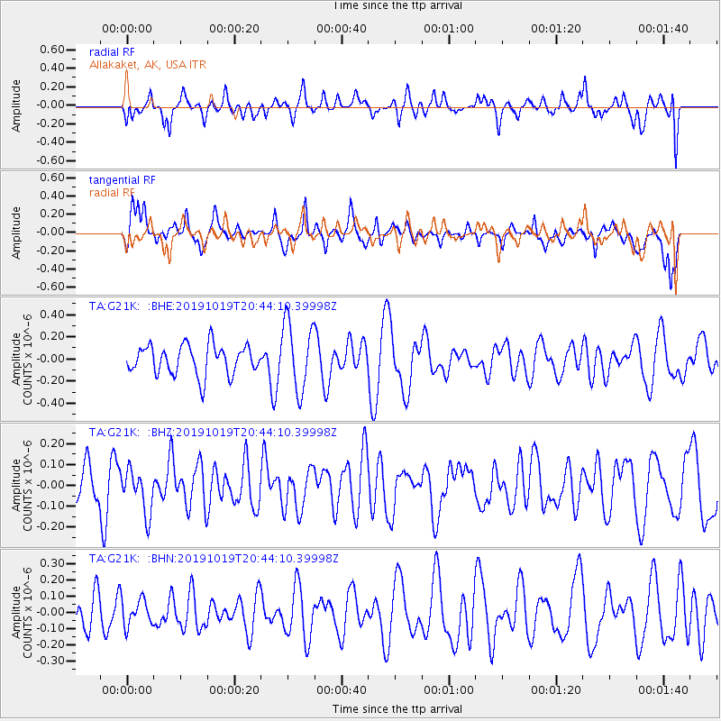
G21K Allakaket, AK, USA - Earthquake Result Viewer
*The percent match for this event was below the threshold and hence no stack was calculated.
| Earthquake location: |
Fiji Islands |
| Earthquake latitude/longitude: |
-18.9/178.1 |
| Earthquake time(UTC): |
2019/10/19 (292) 20:31:56 GMT |
| Earthquake Depth: |
37 km |
| Earthquake Magnitude: |
5.7 Mww |
| Earthquake Catalog/Contributor: |
NEIC PDE/us |
|
| Network: |
TA USArray Transportable Network (new EarthScope stations) |
| Station: |
G21K Allakaket, AK, USA |
| Lat/Lon: |
66.52 N/153.51 W |
| Elevation: |
446 m |
|
| Distance: |
87.8 deg |
| Az: |
11.0 deg |
| Baz: |
206.797 deg |
| Ray Param: |
$rayparam |
*The percent match for this event was below the threshold and hence was not used in the summary stack. |
|
| Radial Match: |
48.11408 % |
| Radial Bump: |
400 |
| Transverse Match: |
52.34635 % |
| Transverse Bump: |
380 |
| SOD ConfigId: |
19951751 |
| Insert Time: |
2019-11-02 20:41:00.960 +0000 |
| GWidth: |
2.5 |
| Max Bumps: |
400 |
| Tol: |
0.001 |
|
Signal To Noise
| Channel | StoN | STA | LTA |
| TA:G21K: :BHZ:20191019T20:44:10.39998Z | 0.76521194 | 1.0537355E-7 | 1.3770506E-7 |
| TA:G21K: :BHN:20191019T20:44:10.39998Z | 0.7595099 | 7.831482E-8 | 1.031123E-7 |
| TA:G21K: :BHE:20191019T20:44:10.39998Z | 2.360055 | 3.1261234E-7 | 1.3245976E-7 |
| Arrivals |
| Ps | |
| PpPs | |
| PsPs/PpSs | |


