You are here: Home > Network List > TA - USArray Transportable Network (new EarthScope stations) Stations List
> Station U17A Shonto, AZ, USA > Earthquake Result Viewer
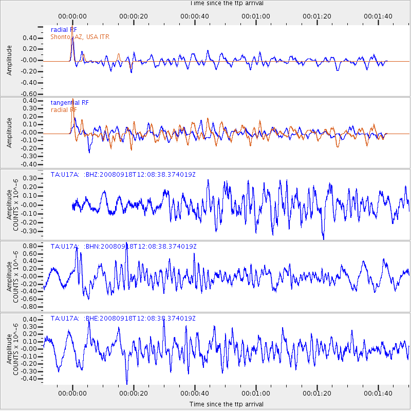
U17A Shonto, AZ, USA - Earthquake Result Viewer
*The percent match for this event was below the threshold and hence no stack was calculated.
| Earthquake location: |
Near East Coast Of Kamchatka |
| Earthquake latitude/longitude: |
51.9/158.4 |
| Earthquake time(UTC): |
2008/09/18 (262) 11:58:50 GMT |
| Earthquake Depth: |
67 km |
| Earthquake Magnitude: |
5.7 MB, 5.9 MW, 5.8 MW |
| Earthquake Catalog/Contributor: |
WHDF/NEIC |
|
| Network: |
TA USArray Transportable Network (new EarthScope stations) |
| Station: |
U17A Shonto, AZ, USA |
| Lat/Lon: |
36.60 N/110.66 W |
| Elevation: |
1976 m |
|
| Distance: |
62.8 deg |
| Az: |
64.828 deg |
| Baz: |
315.852 deg |
| Ray Param: |
$rayparam |
*The percent match for this event was below the threshold and hence was not used in the summary stack. |
|
| Radial Match: |
71.37736 % |
| Radial Bump: |
400 |
| Transverse Match: |
65.51668 % |
| Transverse Bump: |
400 |
| SOD ConfigId: |
2504 |
| Insert Time: |
2010-03-07 05:04:58.079 +0000 |
| GWidth: |
2.5 |
| Max Bumps: |
400 |
| Tol: |
0.001 |
|
Signal To Noise
| Channel | StoN | STA | LTA |
| TA:U17A: :BHN:20080918T12:08:38.374019Z | 3.5057762 | 3.6840768E-7 | 1.0508591E-7 |
| TA:U17A: :BHE:20080918T12:08:38.374019Z | 2.005714 | 1.633492E-7 | 8.144192E-8 |
| TA:U17A: :BHZ:20080918T12:08:38.374019Z | 1.823243 | 1.0689459E-7 | 5.862882E-8 |
| Arrivals |
| Ps | |
| PpPs | |
| PsPs/PpSs | |


