You are here: Home > Network List > TA - USArray Transportable Network (new EarthScope stations) Stations List
> Station U17A Shonto, AZ, USA > Earthquake Result Viewer
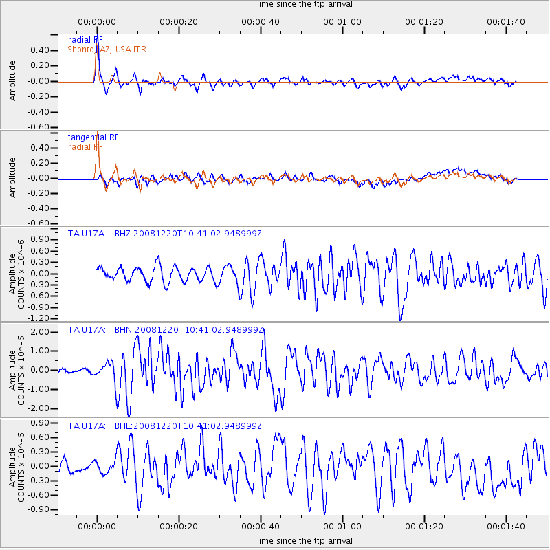
U17A Shonto, AZ, USA - Earthquake Result Viewer
*The percent match for this event was below the threshold and hence no stack was calculated.
| Earthquake location: |
Off East Coast Of Honshu, Japan |
| Earthquake latitude/longitude: |
36.5/142.4 |
| Earthquake time(UTC): |
2008/12/20 (355) 10:29:23 GMT |
| Earthquake Depth: |
19 km |
| Earthquake Magnitude: |
6.0 MB, 6.3 MS, 6.3 MW, 6.3 MW |
| Earthquake Catalog/Contributor: |
WHDF/NEIC |
|
| Network: |
TA USArray Transportable Network (new EarthScope stations) |
| Station: |
U17A Shonto, AZ, USA |
| Lat/Lon: |
36.60 N/110.66 W |
| Elevation: |
1976 m |
|
| Distance: |
80.6 deg |
| Az: |
51.299 deg |
| Baz: |
308.648 deg |
| Ray Param: |
$rayparam |
*The percent match for this event was below the threshold and hence was not used in the summary stack. |
|
| Radial Match: |
77.69067 % |
| Radial Bump: |
400 |
| Transverse Match: |
57.696743 % |
| Transverse Bump: |
400 |
| SOD ConfigId: |
2658 |
| Insert Time: |
2010-03-07 05:05:00.238 +0000 |
| GWidth: |
2.5 |
| Max Bumps: |
400 |
| Tol: |
0.001 |
|
Signal To Noise
| Channel | StoN | STA | LTA |
| TA:U17A: :BHN:20081220T10:41:02.948999Z | 4.346929 | 5.1328885E-7 | 1.180808E-7 |
| TA:U17A: :BHE:20081220T10:41:02.948999Z | 0.77084804 | 1.3688371E-7 | 1.7757547E-7 |
| TA:U17A: :BHZ:20081220T10:41:02.948999Z | 1.3747834 | 2.586573E-7 | 1.8814404E-7 |
| Arrivals |
| Ps | |
| PpPs | |
| PsPs/PpSs | |


