You are here: Home > Network List > TA - USArray Transportable Network (new EarthScope stations) Stations List
> Station U17A Shonto, AZ, USA > Earthquake Result Viewer
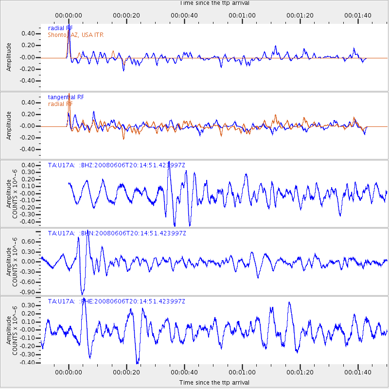
U17A Shonto, AZ, USA - Earthquake Result Viewer
*The percent match for this event was below the threshold and hence no stack was calculated.
| Earthquake location: |
Northern Algeria |
| Earthquake latitude/longitude: |
35.9/-0.7 |
| Earthquake time(UTC): |
2008/06/06 (158) 20:02:56 GMT |
| Earthquake Depth: |
4.0 km |
| Earthquake Magnitude: |
5.5 MB, 5.3 MS, 5.5 MW, 5.5 MW |
| Earthquake Catalog/Contributor: |
WHDF/NEIC |
|
| Network: |
TA USArray Transportable Network (new EarthScope stations) |
| Station: |
U17A Shonto, AZ, USA |
| Lat/Lon: |
36.60 N/110.66 W |
| Elevation: |
1976 m |
|
| Distance: |
82.9 deg |
| Az: |
310.363 deg |
| Baz: |
50.256 deg |
| Ray Param: |
$rayparam |
*The percent match for this event was below the threshold and hence was not used in the summary stack. |
|
| Radial Match: |
76.502815 % |
| Radial Bump: |
400 |
| Transverse Match: |
55.770172 % |
| Transverse Bump: |
400 |
| SOD ConfigId: |
2504 |
| Insert Time: |
2010-03-07 05:05:22.658 +0000 |
| GWidth: |
2.5 |
| Max Bumps: |
400 |
| Tol: |
0.001 |
|
Signal To Noise
| Channel | StoN | STA | LTA |
| TA:U17A: :BHN:20080606T20:14:51.423997Z | 3.786464 | 4.133291E-7 | 1.0915966E-7 |
| TA:U17A: :BHE:20080606T20:14:51.423997Z | 1.2540065 | 1.0443827E-7 | 8.328367E-8 |
| TA:U17A: :BHZ:20080606T20:14:51.423997Z | 1.7215475 | 1.7848356E-7 | 1.03676236E-7 |
| Arrivals |
| Ps | |
| PpPs | |
| PsPs/PpSs | |


