O24A Longmont, CO, USA - Earthquake Result Viewer
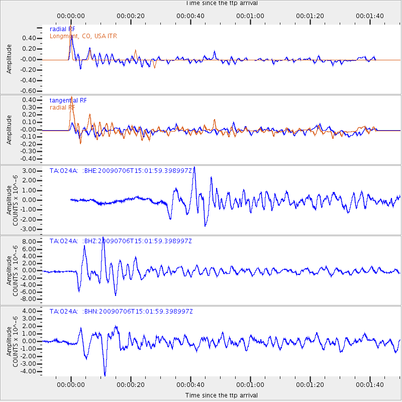
Earthquake location: Rat Islands, Aleutian Islands
Earthquake latitude/longitude: 50.4/177.0
Earthquake time(UTC): 2009/07/06 (187) 14:53:12 GMT
Earthquake Depth: 22 km
Earthquake Magnitude: 6.0 MB, 5.8 MS, 6.1 MW, 6.0 MW
Earthquake Catalog/Contributor: WHDF/NEIC
Network: TA USArray Transportable Network (new EarthScope stations)
Station: O24A Longmont, CO, USA
Lat/Lon: 40.12 N/105.07 W
Elevation: 1553 m
Distance: 53.4 deg
Az: 69.038 deg
Baz: 308.85 deg
Ray Param: 0.06608285
Estimated Moho Depth: 14.0 km
Estimated Crust Vp/Vs: 2.07
Assumed Crust Vp: 6.306 km/s
Estimated Crust Vs: 3.046 km/s
Estimated Crust Poisson's Ratio: 0.35
Radial Match: 91.88025 %
Radial Bump: 400
Transverse Match: 81.574196 %
Transverse Bump: 400
SOD ConfigId: 2648
Insert Time: 2010-03-07 05:06:18.833 +0000
GWidth: 2.5
Max Bumps: 400
Tol: 0.001

Signal To Noise

ChannelStoNSTALTA
TA:O24A: :BHZ:20090706T15:01:59.398997Z20.4218653.005576E-61.4717442E-7
TA:O24A: :BHN:20090706T15:01:59.398997Z4.95948658.426355E-71.6990377E-7
TA:O24A: :BHE:20090706T15:01:59.398997Z4.51848138.495213E-71.8801036E-7
Arrivals
Ps2.5 SECOND
PpPs6.5 SECOND
PsPs/PpSs9.0 SECOND