You are here: Home > Network List > TA - USArray Transportable Network (new EarthScope stations) Stations List
> Station O24A Longmont, CO, USA > Earthquake Result Viewer
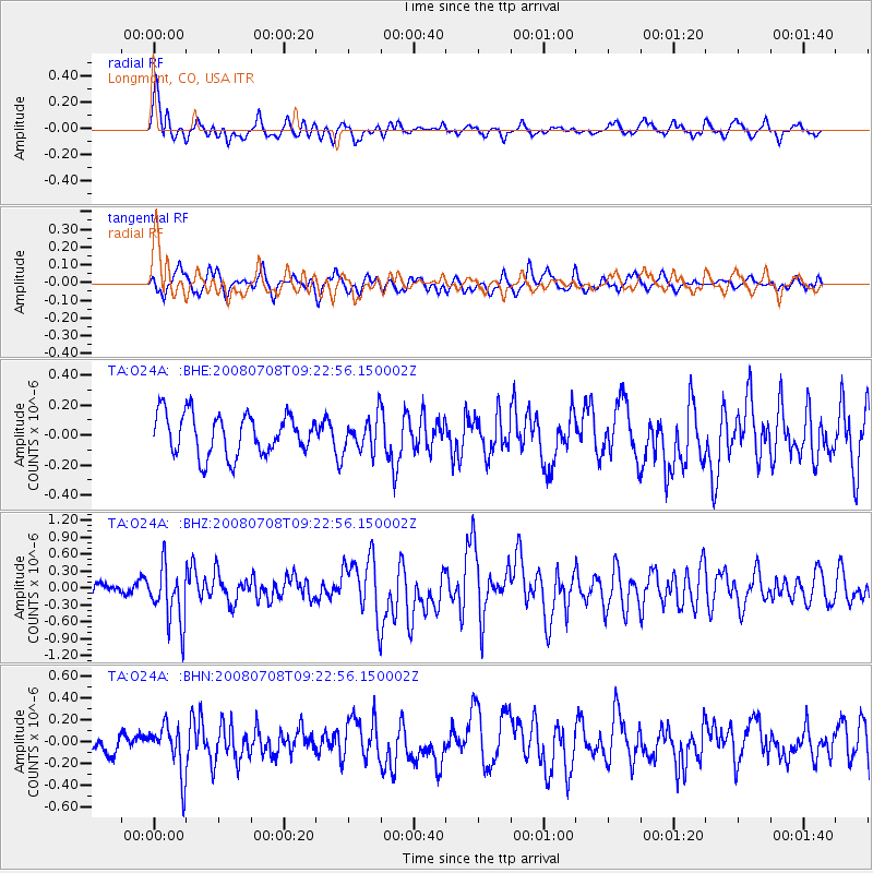
O24A Longmont, CO, USA - Earthquake Result Viewer
*The percent match for this event was below the threshold and hence no stack was calculated.
| Earthquake location: |
Southern Peru |
| Earthquake latitude/longitude: |
-16.0/-71.7 |
| Earthquake time(UTC): |
2008/07/08 (190) 09:13:07 GMT |
| Earthquake Depth: |
123 km |
| Earthquake Magnitude: |
5.8 MB, 6.2 MW, 6.2 MW |
| Earthquake Catalog/Contributor: |
WHDF/NEIC |
|
| Network: |
TA USArray Transportable Network (new EarthScope stations) |
| Station: |
O24A Longmont, CO, USA |
| Lat/Lon: |
40.12 N/105.07 W |
| Elevation: |
1553 m |
|
| Distance: |
63.9 deg |
| Az: |
332.014 deg |
| Baz: |
143.942 deg |
| Ray Param: |
$rayparam |
*The percent match for this event was below the threshold and hence was not used in the summary stack. |
|
| Radial Match: |
75.07509 % |
| Radial Bump: |
400 |
| Transverse Match: |
63.904484 % |
| Transverse Bump: |
400 |
| SOD ConfigId: |
2504 |
| Insert Time: |
2010-03-07 05:06:35.170 +0000 |
| GWidth: |
2.5 |
| Max Bumps: |
400 |
| Tol: |
0.001 |
|
Signal To Noise
| Channel | StoN | STA | LTA |
| TA:O24A: :BHZ:20080708T09:22:56.150002Z | 5.52639 | 5.10716E-7 | 9.241404E-8 |
| TA:O24A: :BHN:20080708T09:22:56.150002Z | 1.6501447 | 2.216372E-7 | 1.343138E-7 |
| TA:O24A: :BHE:20080708T09:22:56.150002Z | 0.8058867 | 1.1018259E-7 | 1.3672218E-7 |
| Arrivals |
| Ps | |
| PpPs | |
| PsPs/PpSs | |


