You are here: Home > Network List > TA - USArray Transportable Network (new EarthScope stations) Stations List
> Station O24A Longmont, CO, USA > Earthquake Result Viewer
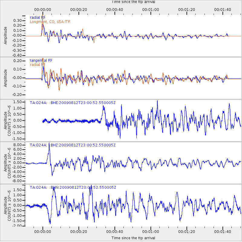
O24A Longmont, CO, USA - Earthquake Result Viewer
*The percent match for this event was below the threshold and hence no stack was calculated.
| Earthquake location: |
Southeast Of Honshu, Japan |
| Earthquake latitude/longitude: |
32.8/140.4 |
| Earthquake time(UTC): |
2009/08/12 (224) 22:48:51 GMT |
| Earthquake Depth: |
53 km |
| Earthquake Magnitude: |
6.2 MB, 6.6 MW, 6.6 MW |
| Earthquake Catalog/Contributor: |
WHDF/NEIC |
|
| Network: |
TA USArray Transportable Network (new EarthScope stations) |
| Station: |
O24A Longmont, CO, USA |
| Lat/Lon: |
40.12 N/105.07 W |
| Elevation: |
1553 m |
|
| Distance: |
85.5 deg |
| Az: |
44.404 deg |
| Baz: |
309.793 deg |
| Ray Param: |
$rayparam |
*The percent match for this event was below the threshold and hence was not used in the summary stack. |
|
| Radial Match: |
87.57285 % |
| Radial Bump: |
400 |
| Transverse Match: |
88.75893 % |
| Transverse Bump: |
400 |
| SOD ConfigId: |
2622 |
| Insert Time: |
2010-03-07 05:06:53.768 +0000 |
| GWidth: |
2.5 |
| Max Bumps: |
400 |
| Tol: |
0.001 |
|
Signal To Noise
| Channel | StoN | STA | LTA |
| TA:O24A: :BHZ:20090812T23:00:52.550005Z | 25.536978 | 2.8848012E-6 | 1.12965644E-7 |
| TA:O24A: :BHN:20090812T23:00:52.550005Z | 9.955989 | 7.0218573E-7 | 7.052898E-8 |
| TA:O24A: :BHE:20090812T23:00:52.550005Z | 7.1752334 | 5.0872086E-7 | 7.089955E-8 |
| Arrivals |
| Ps | |
| PpPs | |
| PsPs/PpSs | |


