You are here: Home > Network List > UU - University of Utah Regional Network Stations List
> Station KNB Kanab, UT, USA > Earthquake Result Viewer
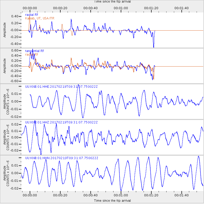
KNB Kanab, UT, USA - Earthquake Result Viewer
*The percent match for this event was below the threshold and hence no stack was calculated.
| Earthquake location: |
Near East Coast Of Honshu, Japan |
| Earthquake latitude/longitude: |
35.6/140.8 |
| Earthquake time(UTC): |
2017/02/19 (050) 09:19:30 GMT |
| Earthquake Depth: |
39 km |
| Earthquake Magnitude: |
5.5 mb |
| Earthquake Catalog/Contributor: |
NEIC PDE/us |
|
| Network: |
UU University of Utah Regional Network |
| Station: |
KNB Kanab, UT, USA |
| Lat/Lon: |
37.02 N/112.82 W |
| Elevation: |
1715 m |
|
| Distance: |
80.6 deg |
| Az: |
51.121 deg |
| Baz: |
307.599 deg |
| Ray Param: |
$rayparam |
*The percent match for this event was below the threshold and hence was not used in the summary stack. |
|
| Radial Match: |
58.73467 % |
| Radial Bump: |
400 |
| Transverse Match: |
66.91723 % |
| Transverse Bump: |
400 |
| SOD ConfigId: |
1992691 |
| Insert Time: |
2017-03-05 09:23:31.469 +0000 |
| GWidth: |
2.5 |
| Max Bumps: |
400 |
| Tol: |
0.001 |
|
Signal To Noise
| Channel | StoN | STA | LTA |
| UU:KNB:01:HHZ:20170219T09:31:07.750022Z | 2.2643294 | 1.6721755E-8 | 7.384859E-9 |
| UU:KNB:01:HHN:20170219T09:31:07.750022Z | 1.2010747 | 1.0414275E-8 | 8.6707965E-9 |
| UU:KNB:01:HHE:20170219T09:31:07.750022Z | 1.8582327 | 1.3651989E-8 | 7.346759E-9 |
| Arrivals |
| Ps | |
| PpPs | |
| PsPs/PpSs | |


