You are here: Home > Network List > TA - USArray Transportable Network (new EarthScope stations) Stations List
> Station O24A Longmont, CO, USA > Earthquake Result Viewer
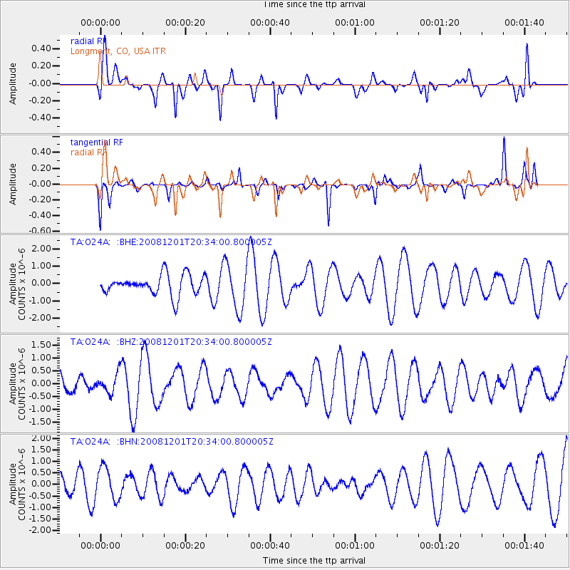
O24A Longmont, CO, USA - Earthquake Result Viewer
*The percent match for this event was below the threshold and hence no stack was calculated.
| Earthquake location: |
Tonga Islands Region |
| Earthquake latitude/longitude: |
-22.9/-175.2 |
| Earthquake time(UTC): |
2008/12/01 (336) 20:21:34 GMT |
| Earthquake Depth: |
39 km |
| Earthquake Magnitude: |
5.5 MB, 5.1 MS |
| Earthquake Catalog/Contributor: |
WHDF/NEIC |
|
| Network: |
TA USArray Transportable Network (new EarthScope stations) |
| Station: |
O24A Longmont, CO, USA |
| Lat/Lon: |
40.12 N/105.07 W |
| Elevation: |
1553 m |
|
| Distance: |
90.5 deg |
| Az: |
46.146 deg |
| Baz: |
240.103 deg |
| Ray Param: |
$rayparam |
*The percent match for this event was below the threshold and hence was not used in the summary stack. |
|
| Radial Match: |
52.729797 % |
| Radial Bump: |
368 |
| Transverse Match: |
47.68198 % |
| Transverse Bump: |
275 |
| SOD ConfigId: |
2658 |
| Insert Time: |
2010-03-07 05:07:07.774 +0000 |
| GWidth: |
2.5 |
| Max Bumps: |
400 |
| Tol: |
0.001 |
|
Signal To Noise
| Channel | StoN | STA | LTA |
| TA:O24A: :BHZ:20081201T20:34:00.800005Z | 0.45903683 | 4.0703173E-7 | 8.867082E-7 |
| TA:O24A: :BHN:20081201T20:34:00.800005Z | 1.0815284 | 6.996188E-7 | 6.468797E-7 |
| TA:O24A: :BHE:20081201T20:34:00.800005Z | 2.4001784 | 1.3842739E-6 | 5.7673793E-7 |
| Arrivals |
| Ps | |
| PpPs | |
| PsPs/PpSs | |


