You are here: Home > Network List > TA - USArray Transportable Network (new EarthScope stations) Stations List
> Station E20K Nigu River, AK, USA > Earthquake Result Viewer
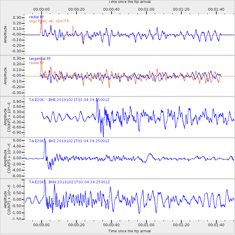
E20K Nigu River, AK, USA - Earthquake Result Viewer
*The percent match for this event was below the threshold and hence no stack was calculated.
| Earthquake location: |
Vanuatu Islands |
| Earthquake latitude/longitude: |
-19.0/169.5 |
| Earthquake time(UTC): |
2019/10/21 (294) 02:52:29 GMT |
| Earthquake Depth: |
226 km |
| Earthquake Magnitude: |
6.4 Mww |
| Earthquake Catalog/Contributor: |
NEIC PDE/us |
|
| Network: |
TA USArray Transportable Network (new EarthScope stations) |
| Station: |
E20K Nigu River, AK, USA |
| Lat/Lon: |
68.26 N/156.19 W |
| Elevation: |
866 m |
|
| Distance: |
90.6 deg |
| Az: |
12.139 deg |
| Baz: |
212.269 deg |
| Ray Param: |
$rayparam |
*The percent match for this event was below the threshold and hence was not used in the summary stack. |
|
| Radial Match: |
77.83891 % |
| Radial Bump: |
400 |
| Transverse Match: |
78.23839 % |
| Transverse Bump: |
400 |
| SOD ConfigId: |
19951751 |
| Insert Time: |
2019-11-04 03:03:56.504 +0000 |
| GWidth: |
2.5 |
| Max Bumps: |
400 |
| Tol: |
0.001 |
|
Signal To Noise
| Channel | StoN | STA | LTA |
| TA:E20K: :BHZ:20191021T03:04:34.25001Z | 13.006024 | 2.638473E-6 | 2.0286545E-7 |
| TA:E20K: :BHN:20191021T03:04:34.25001Z | 3.4355361 | 5.76794E-7 | 1.6789052E-7 |
| TA:E20K: :BHE:20191021T03:04:34.25001Z | 2.7210822 | 4.3184917E-7 | 1.5870494E-7 |
| Arrivals |
| Ps | |
| PpPs | |
| PsPs/PpSs | |


