You are here: Home > Network List > TA - USArray Transportable Network (new EarthScope stations) Stations List
> Station M31M Drury Creek, Yukon, CA > Earthquake Result Viewer
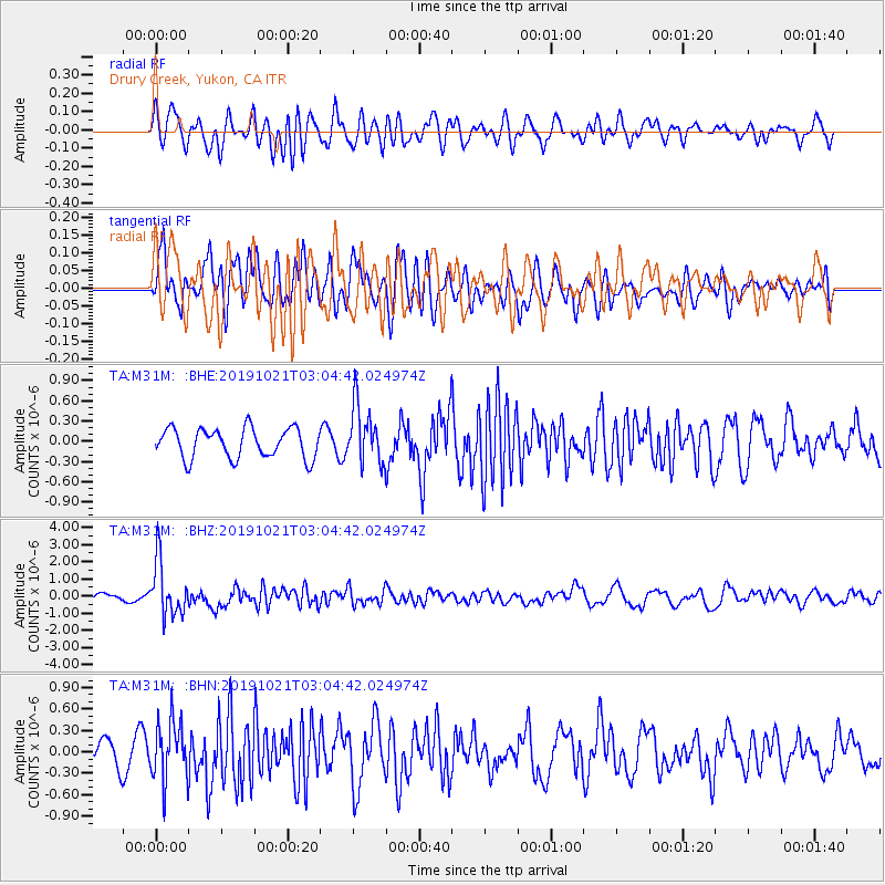
M31M Drury Creek, Yukon, CA - Earthquake Result Viewer
*The percent match for this event was below the threshold and hence no stack was calculated.
| Earthquake location: |
Vanuatu Islands |
| Earthquake latitude/longitude: |
-19.0/169.5 |
| Earthquake time(UTC): |
2019/10/21 (294) 02:52:29 GMT |
| Earthquake Depth: |
226 km |
| Earthquake Magnitude: |
6.4 Mww |
| Earthquake Catalog/Contributor: |
NEIC PDE/us |
|
| Network: |
TA USArray Transportable Network (new EarthScope stations) |
| Station: |
M31M Drury Creek, Yukon, CA |
| Lat/Lon: |
62.20 N/134.39 W |
| Elevation: |
639 m |
|
| Distance: |
92.3 deg |
| Az: |
22.934 deg |
| Baz: |
231.84 deg |
| Ray Param: |
$rayparam |
*The percent match for this event was below the threshold and hence was not used in the summary stack. |
|
| Radial Match: |
62.148785 % |
| Radial Bump: |
400 |
| Transverse Match: |
64.36774 % |
| Transverse Bump: |
400 |
| SOD ConfigId: |
19951751 |
| Insert Time: |
2019-11-04 03:04:42.812 +0000 |
| GWidth: |
2.5 |
| Max Bumps: |
400 |
| Tol: |
0.001 |
|
Signal To Noise
| Channel | StoN | STA | LTA |
| TA:M31M: :BHZ:20191021T03:04:42.024974Z | 8.05268 | 1.5839478E-6 | 1.9669822E-7 |
| TA:M31M: :BHN:20191021T03:04:42.024974Z | 2.3372974 | 4.1095467E-7 | 1.7582472E-7 |
| TA:M31M: :BHE:20191021T03:04:42.024974Z | 1.9347583 | 4.2747632E-7 | 2.209456E-7 |
| Arrivals |
| Ps | |
| PpPs | |
| PsPs/PpSs | |


