You are here: Home > Network List > TA - USArray Transportable Network (new EarthScope stations) Stations List
> Station G21K Allakaket, AK, USA > Earthquake Result Viewer
G21K Allakaket, AK, USA - Earthquake Result Viewer
*The percent match for this event was below the threshold and hence no stack was calculated.
| Earthquake location: |
Southern Iran |
| Earthquake latitude/longitude: |
27.2/55.0 |
| Earthquake time(UTC): |
2019/10/21 (294) 10:58:52 GMT |
| Earthquake Depth: |
10 km |
| Earthquake Magnitude: |
5.4 Mww |
| Earthquake Catalog/Contributor: |
NEIC PDE/us |
|
| Network: |
TA USArray Transportable Network (new EarthScope stations) |
| Station: |
G21K Allakaket, AK, USA |
| Lat/Lon: |
66.52 N/153.51 W |
| Elevation: |
446 m |
|
| Distance: |
84.1 deg |
| Az: |
11.08 deg |
| Baz: |
334.72 deg |
| Ray Param: |
$rayparam |
*The percent match for this event was below the threshold and hence was not used in the summary stack. |
|
| Radial Match: |
54.69027 % |
| Radial Bump: |
400 |
| Transverse Match: |
52.906055 % |
| Transverse Bump: |
400 |
| SOD ConfigId: |
19951751 |
| Insert Time: |
2019-11-04 11:08:02.510 +0000 |
| GWidth: |
2.5 |
| Max Bumps: |
400 |
| Tol: |
0.001 |
|
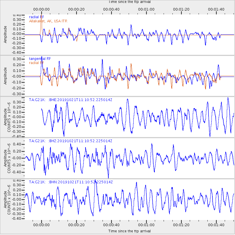
Signal To Noise
| Channel | StoN | STA | LTA |
| TA:G21K: :BHZ:20191021T11:10:52.225014Z | 2.7472997 | 2.3851217E-7 | 8.681695E-8 |
| TA:G21K: :BHN:20191021T11:10:52.225014Z | 0.54943144 | 6.995852E-8 | 1.2732893E-7 |
| TA:G21K: :BHE:20191021T11:10:52.225014Z | 0.7774346 | 1.09574295E-7 | 1.4094343E-7 |
| Arrivals |
| Ps | |
| PpPs | |
| PsPs/PpSs | |


