You are here: Home > Network List > GS - US Geological Survey Networks Stations List
> Station DEC06 Boomer > Earthquake Result Viewer
DEC06 Boomer - Earthquake Result Viewer
*The percent match for this event was below the threshold and hence no stack was calculated.
| Earthquake location: |
Southern Bolivia |
| Earthquake latitude/longitude: |
-19.3/-63.9 |
| Earthquake time(UTC): |
2017/02/21 (052) 14:09:04 GMT |
| Earthquake Depth: |
598 km |
| Earthquake Magnitude: |
6.5 Mww |
| Earthquake Catalog/Contributor: |
NEIC PDE/us |
|
| Network: |
GS US Geological Survey Networks |
| Station: |
DEC06 Boomer |
| Lat/Lon: |
39.90 N/88.95 W |
| Elevation: |
215 m |
|
| Distance: |
63.3 deg |
| Az: |
338.627 deg |
| Baz: |
153.419 deg |
| Ray Param: |
$rayparam |
*The percent match for this event was below the threshold and hence was not used in the summary stack. |
|
| Radial Match: |
36.681755 % |
| Radial Bump: |
400 |
| Transverse Match: |
58.939243 % |
| Transverse Bump: |
400 |
| SOD ConfigId: |
1992691 |
| Insert Time: |
2017-03-07 14:12:25.876 +0000 |
| GWidth: |
2.5 |
| Max Bumps: |
400 |
| Tol: |
0.001 |
|
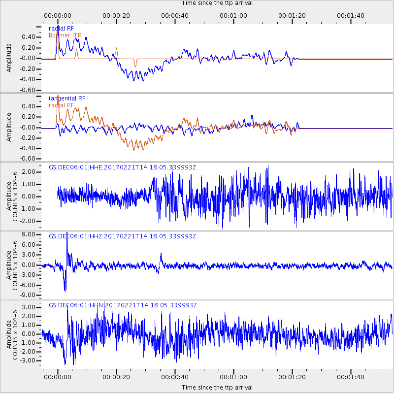
Signal To Noise
| Channel | StoN | STA | LTA |
| GS:DEC06:01:HHZ:20170221T14:18:05.339993Z | 15.914854 | 3.0425965E-6 | 1.9117967E-7 |
| GS:DEC06:01:HHN:20170221T14:18:05.339993Z | 3.0274024 | 1.5421837E-6 | 5.094082E-7 |
| GS:DEC06:01:HHE:20170221T14:18:05.339993Z | 1.860576 | 7.253892E-7 | 3.8987346E-7 |
| Arrivals |
| Ps | |
| PpPs | |
| PsPs/PpSs | |


