You are here: Home > Network List > GS - US Geological Survey Networks Stations List
> Station KAN08 Pence Farm, Harper, KS, USA > Earthquake Result Viewer
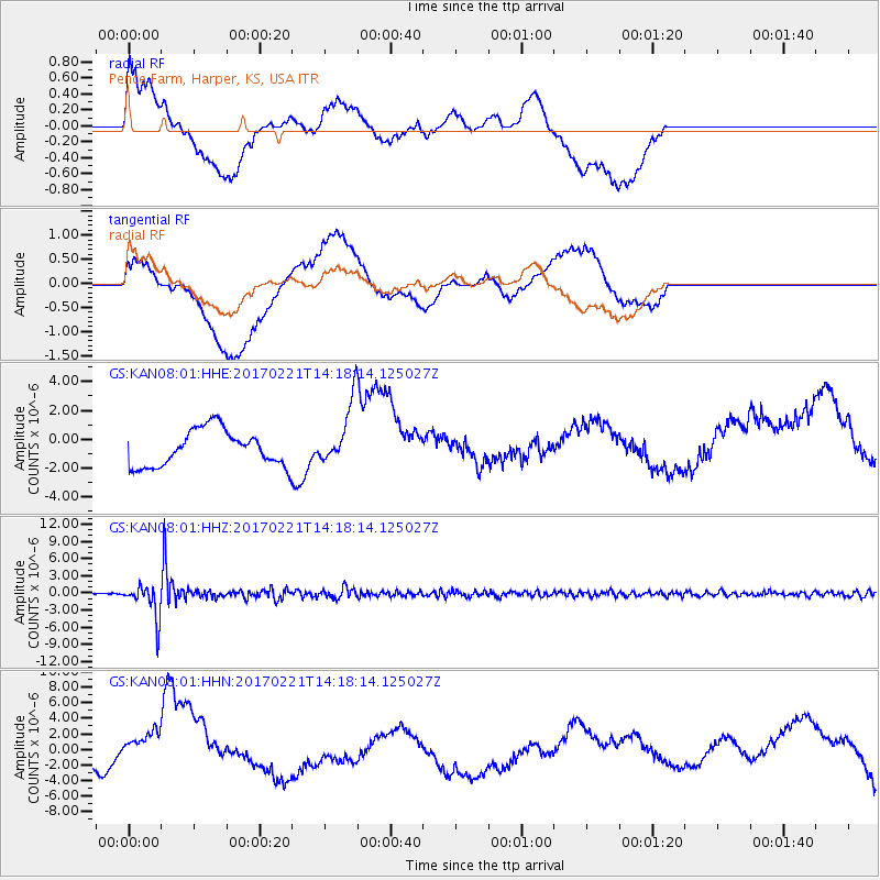
KAN08 Pence Farm, Harper, KS, USA - Earthquake Result Viewer
*The percent match for this event was below the threshold and hence no stack was calculated.
| Earthquake location: |
Southern Bolivia |
| Earthquake latitude/longitude: |
-19.3/-63.9 |
| Earthquake time(UTC): |
2017/02/21 (052) 14:09:04 GMT |
| Earthquake Depth: |
598 km |
| Earthquake Magnitude: |
6.5 Mww |
| Earthquake Catalog/Contributor: |
NEIC PDE/us |
|
| Network: |
GS US Geological Survey Networks |
| Station: |
KAN08 Pence Farm, Harper, KS, USA |
| Lat/Lon: |
37.23 N/97.97 W |
| Elevation: |
375 m |
|
| Distance: |
64.7 deg |
| Az: |
330.365 deg |
| Baz: |
144.186 deg |
| Ray Param: |
$rayparam |
*The percent match for this event was below the threshold and hence was not used in the summary stack. |
|
| Radial Match: |
16.862646 % |
| Radial Bump: |
400 |
| Transverse Match: |
19.662067 % |
| Transverse Bump: |
400 |
| SOD ConfigId: |
1992691 |
| Insert Time: |
2017-03-07 14:12:36.152 +0000 |
| GWidth: |
2.5 |
| Max Bumps: |
400 |
| Tol: |
0.001 |
|
Signal To Noise
| Channel | StoN | STA | LTA |
| GS:KAN08:01:HHZ:20170221T14:18:14.125027Z | 16.056566 | 2.9993128E-6 | 1.8679665E-7 |
| GS:KAN08:01:HHN:20170221T14:18:14.125027Z | 2.0498476 | 2.604842E-6 | 1.2707491E-6 |
| GS:KAN08:01:HHE:20170221T14:18:14.125027Z | 1.6939545 | 2.108631E-6 | 1.2447979E-6 |
| Arrivals |
| Ps | |
| PpPs | |
| PsPs/PpSs | |


