You are here: Home > Network List > TA - USArray Transportable Network (new EarthScope stations) Stations List
> Station E20K Nigu River, AK, USA > Earthquake Result Viewer
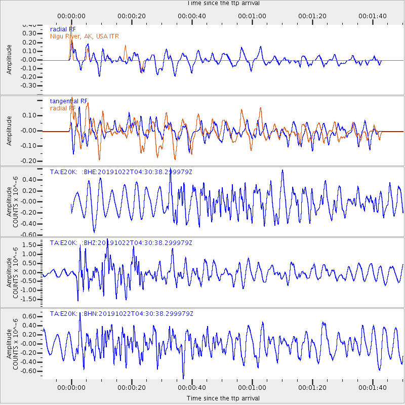
E20K Nigu River, AK, USA - Earthquake Result Viewer
*The percent match for this event was below the threshold and hence no stack was calculated.
| Earthquake location: |
Tonga Islands |
| Earthquake latitude/longitude: |
-15.2/-173.0 |
| Earthquake time(UTC): |
2019/10/22 (295) 04:18:38 GMT |
| Earthquake Depth: |
10 km |
| Earthquake Magnitude: |
5.8 mb |
| Earthquake Catalog/Contributor: |
NEIC PDE/us |
|
| Network: |
TA USArray Transportable Network (new EarthScope stations) |
| Station: |
E20K Nigu River, AK, USA |
| Lat/Lon: |
68.26 N/156.19 W |
| Elevation: |
866 m |
|
| Distance: |
84.1 deg |
| Az: |
6.237 deg |
| Baz: |
196.351 deg |
| Ray Param: |
$rayparam |
*The percent match for this event was below the threshold and hence was not used in the summary stack. |
|
| Radial Match: |
47.955906 % |
| Radial Bump: |
400 |
| Transverse Match: |
68.92519 % |
| Transverse Bump: |
400 |
| SOD ConfigId: |
19951751 |
| Insert Time: |
2019-11-05 04:33:44.028 +0000 |
| GWidth: |
2.5 |
| Max Bumps: |
400 |
| Tol: |
0.001 |
|
Signal To Noise
| Channel | StoN | STA | LTA |
| TA:E20K: :BHZ:20191022T04:30:38.299979Z | 4.8214316 | 6.42853E-7 | 1.3333239E-7 |
| TA:E20K: :BHN:20191022T04:30:38.299979Z | 1.328067 | 2.8593564E-7 | 2.1530212E-7 |
| TA:E20K: :BHE:20191022T04:30:38.299979Z | 1.0791413 | 2.474358E-7 | 2.2928953E-7 |
| Arrivals |
| Ps | |
| PpPs | |
| PsPs/PpSs | |


