You are here: Home > Network List > TA - USArray Transportable Network (new EarthScope stations) Stations List
> Station T16A Glen Canyon Dam (National Park Service), Page, AZ, > Earthquake Result Viewer
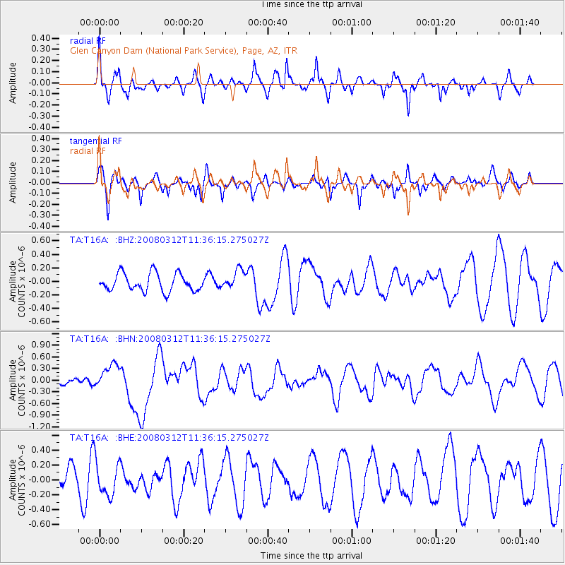
T16A Glen Canyon Dam (National Park Service), Page, AZ, - Earthquake Result Viewer
*The percent match for this event was below the threshold and hence no stack was calculated.
| Earthquake location: |
Vanuatu Islands |
| Earthquake latitude/longitude: |
-16.6/167.3 |
| Earthquake time(UTC): |
2008/03/12 (072) 11:23:34 GMT |
| Earthquake Depth: |
13 km |
| Earthquake Magnitude: |
5.8 MB, 6.4 MS, 6.4 MW, 6.4 MW |
| Earthquake Catalog/Contributor: |
WHDF/NEIC |
|
| Network: |
TA USArray Transportable Network (new EarthScope stations) |
| Station: |
T16A Glen Canyon Dam (National Park Service), Page, AZ, |
| Lat/Lon: |
36.98 N/111.51 W |
| Elevation: |
1177 m |
|
| Distance: |
93.0 deg |
| Az: |
52.4 deg |
| Baz: |
251.601 deg |
| Ray Param: |
$rayparam |
*The percent match for this event was below the threshold and hence was not used in the summary stack. |
|
| Radial Match: |
56.65907 % |
| Radial Bump: |
400 |
| Transverse Match: |
58.41383 % |
| Transverse Bump: |
400 |
| SOD ConfigId: |
2504 |
| Insert Time: |
2010-03-07 05:11:21.273 +0000 |
| GWidth: |
2.5 |
| Max Bumps: |
400 |
| Tol: |
0.001 |
|
Signal To Noise
| Channel | StoN | STA | LTA |
| TA:T16A: :BHN:20080312T11:36:15.275027Z | 3.0880284 | 3.35105E-7 | 1.0851746E-7 |
| TA:T16A: :BHE:20080312T11:36:15.275027Z | 1.2994769 | 2.0425105E-7 | 1.5717944E-7 |
| TA:T16A: :BHZ:20080312T11:36:15.275027Z | 1.11107 | 1.4444097E-7 | 1.300017E-7 |
| Arrivals |
| Ps | |
| PpPs | |
| PsPs/PpSs | |


