You are here: Home > Network List > TX - Texas Seismological Network Stations List
> Station WTFS Witchita Falls > Earthquake Result Viewer
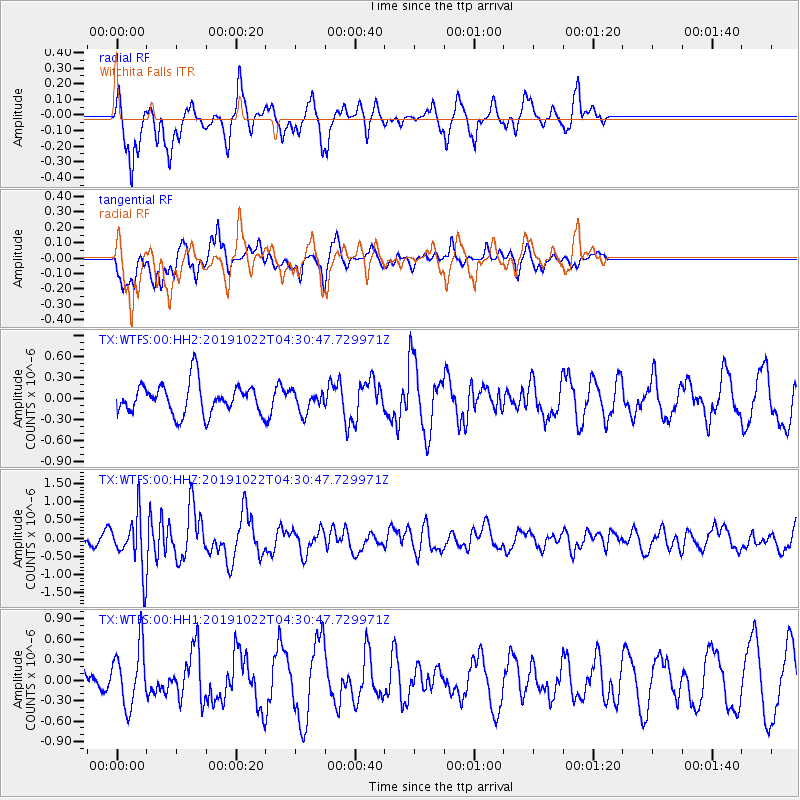
WTFS Witchita Falls - Earthquake Result Viewer
*The percent match for this event was below the threshold and hence no stack was calculated.
| Earthquake location: |
Tonga Islands |
| Earthquake latitude/longitude: |
-15.2/-173.0 |
| Earthquake time(UTC): |
2019/10/22 (295) 04:18:38 GMT |
| Earthquake Depth: |
10 km |
| Earthquake Magnitude: |
5.8 mb |
| Earthquake Catalog/Contributor: |
NEIC PDE/us |
|
| Network: |
TX Texas Seismological Network |
| Station: |
WTFS Witchita Falls |
| Lat/Lon: |
33.77 N/98.46 W |
| Elevation: |
277 m |
|
| Distance: |
86.0 deg |
| Az: |
53.612 deg |
| Baz: |
248.908 deg |
| Ray Param: |
$rayparam |
*The percent match for this event was below the threshold and hence was not used in the summary stack. |
|
| Radial Match: |
81.27755 % |
| Radial Bump: |
398 |
| Transverse Match: |
55.023808 % |
| Transverse Bump: |
400 |
| SOD ConfigId: |
19951751 |
| Insert Time: |
2019-11-05 04:35:21.231 +0000 |
| GWidth: |
2.5 |
| Max Bumps: |
400 |
| Tol: |
0.001 |
|
Signal To Noise
| Channel | StoN | STA | LTA |
| TX:WTFS:00:HHZ:20191022T04:30:47.729971Z | 4.2646 | 7.1437296E-7 | 1.6751233E-7 |
| TX:WTFS:00:HH1:20191022T04:30:47.729971Z | 1.7690037 | 4.3459366E-7 | 2.4567143E-7 |
| TX:WTFS:00:HH2:20191022T04:30:47.729971Z | 0.6922103 | 1.5248084E-7 | 2.202811E-7 |
| Arrivals |
| Ps | |
| PpPs | |
| PsPs/PpSs | |


