You are here: Home > Network List > TA - USArray Transportable Network (new EarthScope stations) Stations List
> Station T16A Glen Canyon Dam (National Park Service), Page, AZ, > Earthquake Result Viewer
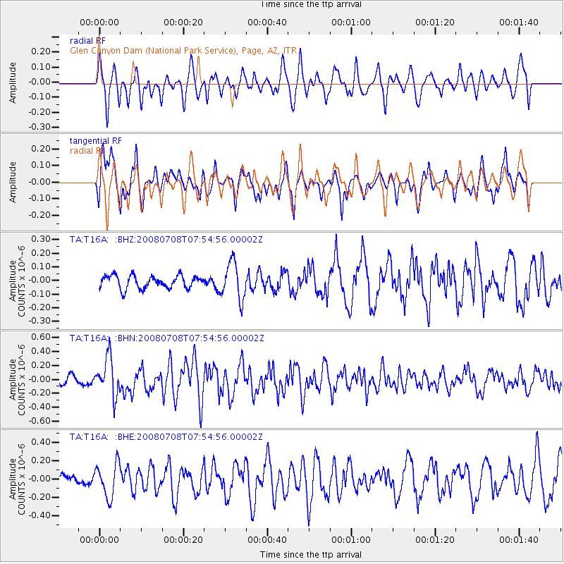
T16A Glen Canyon Dam (National Park Service), Page, AZ, - Earthquake Result Viewer
*The percent match for this event was below the threshold and hence no stack was calculated.
| Earthquake location: |
Ryukyu Islands, Japan |
| Earthquake latitude/longitude: |
27.5/128.3 |
| Earthquake time(UTC): |
2008/07/08 (190) 07:42:10 GMT |
| Earthquake Depth: |
43 km |
| Earthquake Magnitude: |
6.0 MB, 5.5 MS, 6.0 MW, 6.0 MW |
| Earthquake Catalog/Contributor: |
WHDF/NEIC |
|
| Network: |
TA USArray Transportable Network (new EarthScope stations) |
| Station: |
T16A Glen Canyon Dam (National Park Service), Page, AZ, |
| Lat/Lon: |
36.98 N/111.51 W |
| Elevation: |
1177 m |
|
| Distance: |
94.7 deg |
| Az: |
44.001 deg |
| Baz: |
309.611 deg |
| Ray Param: |
$rayparam |
*The percent match for this event was below the threshold and hence was not used in the summary stack. |
|
| Radial Match: |
55.60186 % |
| Radial Bump: |
399 |
| Transverse Match: |
72.73752 % |
| Transverse Bump: |
400 |
| SOD ConfigId: |
2504 |
| Insert Time: |
2010-03-07 05:11:36.190 +0000 |
| GWidth: |
2.5 |
| Max Bumps: |
400 |
| Tol: |
0.001 |
|
Signal To Noise
| Channel | StoN | STA | LTA |
| TA:T16A: :BHN:20080708T07:54:56.00002Z | 2.9250038 | 2.8144225E-7 | 9.621945E-8 |
| TA:T16A: :BHE:20080708T07:54:56.00002Z | 2.09797 | 1.8947404E-7 | 9.031304E-8 |
| TA:T16A: :BHZ:20080708T07:54:56.00002Z | 2.9530492 | 1.3879453E-7 | 4.7000416E-8 |
| Arrivals |
| Ps | |
| PpPs | |
| PsPs/PpSs | |


