You are here: Home > Network List > TA - USArray Transportable Network (new EarthScope stations) Stations List
> Station L12A House Creek Ranch, Rogerson, ID, USA > Earthquake Result Viewer
L12A House Creek Ranch, Rogerson, ID, USA - Earthquake Result Viewer

| Earthquake location: |
Andreanof Islands, Aleutian Is. |
| Earthquake latitude/longitude: |
52.2/-178.7 |
| Earthquake time(UTC): |
2008/03/22 (082) 21:24:11 GMT |
| Earthquake Depth: |
132 km |
| Earthquake Magnitude: |
5.8 MB, 6.2 MW, 6.1 MW |
| Earthquake Catalog/Contributor: |
WHDF/NEIC |
|
| Network: |
TA USArray Transportable Network (new EarthScope stations) |
| Station: |
L12A House Creek Ranch, Rogerson, ID, USA |
| Lat/Lon: |
42.15 N/115.02 W |
| Elevation: |
1756 m |
|
| Distance: |
43.1 deg |
| Az: |
77.15 deg |
| Baz: |
306.165 deg |
| Ray Param: |
0.07225041 |
| Estimated Moho Depth: |
13.5 km |
| Estimated Crust Vp/Vs: |
1.60 |
| Assumed Crust Vp: |
6.291 km/s |
| Estimated Crust Vs: |
3.932 km/s |
| Estimated Crust Poisson's Ratio: |
0.18 |
|
| Radial Match: |
89.9815 % |
| Radial Bump: |
376 |
| Transverse Match: |
75.30694 % |
| Transverse Bump: |
400 |
| SOD ConfigId: |
2564 |
| Insert Time: |
2010-03-07 05:12:03.807 +0000 |
| GWidth: |
2.5 |
| Max Bumps: |
400 |
| Tol: |
0.001 |
|
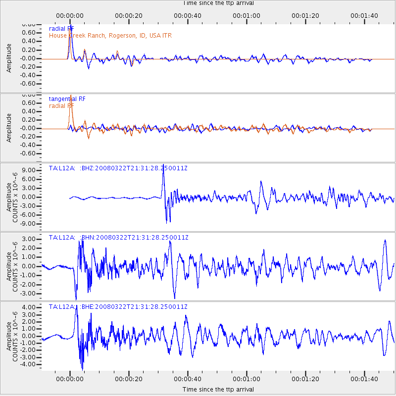
Signal To Noise
| Channel | StoN | STA | LTA |
| TA:L12A: :BHN:20080322T21:31:28.250011Z | 7.550574 | 1.5989827E-6 | 2.117697E-7 |
| TA:L12A: :BHE:20080322T21:31:28.250011Z | 8.304729 | 2.0814264E-6 | 2.5063144E-7 |
| TA:L12A: :BHZ:20080322T21:31:28.250011Z | 19.631823 | 4.0455902E-6 | 2.0607308E-7 |
| Arrivals |
| Ps | 1.4 SECOND |
| PpPs | 5.2 SECOND |
| PsPs/PpSs | 6.6 SECOND |


