You are here: Home > Network List > G - GEOSCOPE Stations List
> Station MPG Montagne des Peres, French Guyana > Earthquake Result Viewer
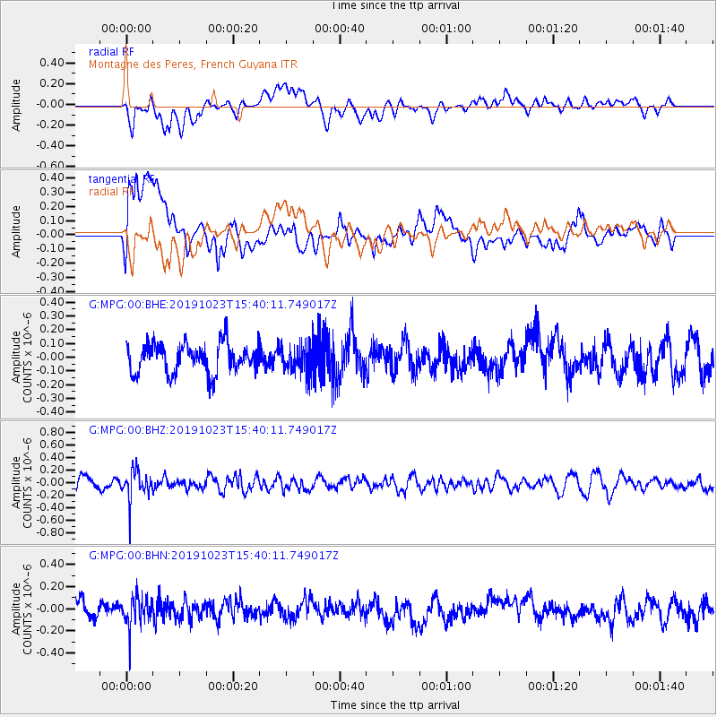
MPG Montagne des Peres, French Guyana - Earthquake Result Viewer
*The percent match for this event was below the threshold and hence no stack was calculated.
| Earthquake location: |
South Sandwich Islands Region |
| Earthquake latitude/longitude: |
-55.9/-27.8 |
| Earthquake time(UTC): |
2019/10/23 (296) 15:30:14 GMT |
| Earthquake Depth: |
68 km |
| Earthquake Magnitude: |
5.6 mb |
| Earthquake Catalog/Contributor: |
NEIC PDE/us |
|
| Network: |
G GEOSCOPE |
| Station: |
MPG Montagne des Peres, French Guyana |
| Lat/Lon: |
5.11 N/52.64 W |
| Elevation: |
147 m |
|
| Distance: |
64.2 deg |
| Az: |
332.309 deg |
| Baz: |
164.781 deg |
| Ray Param: |
$rayparam |
*The percent match for this event was below the threshold and hence was not used in the summary stack. |
|
| Radial Match: |
57.01141 % |
| Radial Bump: |
400 |
| Transverse Match: |
57.69869 % |
| Transverse Bump: |
400 |
| SOD ConfigId: |
19951751 |
| Insert Time: |
2019-11-06 15:36:31.687 +0000 |
| GWidth: |
2.5 |
| Max Bumps: |
400 |
| Tol: |
0.001 |
|
Signal To Noise
| Channel | StoN | STA | LTA |
| G:MPG:00:BHZ:20191023T15:40:11.749017Z | 2.5253463 | 2.3206856E-7 | 9.1895735E-8 |
| G:MPG:00:BHN:20191023T15:40:11.749017Z | 1.8226628 | 1.358231E-7 | 7.451904E-8 |
| G:MPG:00:BHE:20191023T15:40:11.749017Z | 0.9597975 | 1.02507144E-7 | 1.06800805E-7 |
| Arrivals |
| Ps | |
| PpPs | |
| PsPs/PpSs | |


