You are here: Home > Network List > CI - Caltech Regional Seismic Network Stations List
> Station MPP McPhearson Peak > Earthquake Result Viewer
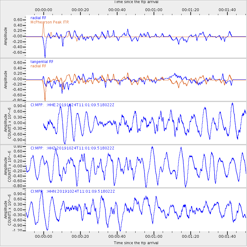
MPP McPhearson Peak - Earthquake Result Viewer
*The percent match for this event was below the threshold and hence no stack was calculated.
| Earthquake location: |
Tonga Islands Region |
| Earthquake latitude/longitude: |
-17.6/-172.8 |
| Earthquake time(UTC): |
2019/10/24 (297) 10:50:14 GMT |
| Earthquake Depth: |
10 km |
| Earthquake Magnitude: |
5.4 mww |
| Earthquake Catalog/Contributor: |
NEIC PDE/us |
|
| Network: |
CI Caltech Regional Seismic Network |
| Station: |
MPP McPhearson Peak |
| Lat/Lon: |
34.89 N/119.81 W |
| Elevation: |
1739 m |
|
| Distance: |
72.5 deg |
| Az: |
43.473 deg |
| Baz: |
232.967 deg |
| Ray Param: |
$rayparam |
*The percent match for this event was below the threshold and hence was not used in the summary stack. |
|
| Radial Match: |
59.412853 % |
| Radial Bump: |
400 |
| Transverse Match: |
48.92856 % |
| Transverse Bump: |
400 |
| SOD ConfigId: |
19951751 |
| Insert Time: |
2019-11-07 10:57:26.443 +0000 |
| GWidth: |
2.5 |
| Max Bumps: |
400 |
| Tol: |
0.001 |
|
Signal To Noise
| Channel | StoN | STA | LTA |
| CI:MPP: :HHZ:20191024T11:01:09.518022Z | 1.1104258 | 3.81293E-7 | 3.433755E-7 |
| CI:MPP: :HHN:20191024T11:01:09.518022Z | 1.965462 | 7.735938E-7 | 3.9359387E-7 |
| CI:MPP: :HHE:20191024T11:01:09.518022Z | 0.1459752 | 7.361916E-8 | 5.043265E-7 |
| Arrivals |
| Ps | |
| PpPs | |
| PsPs/PpSs | |


