You are here: Home > Network List > TA - USArray Transportable Network (new EarthScope stations) Stations List
> Station G21K Allakaket, AK, USA > Earthquake Result Viewer
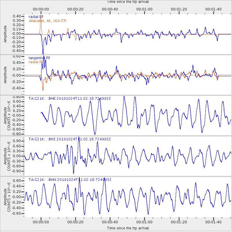
G21K Allakaket, AK, USA - Earthquake Result Viewer
*The percent match for this event was below the threshold and hence no stack was calculated.
| Earthquake location: |
Tonga Islands Region |
| Earthquake latitude/longitude: |
-17.6/-172.8 |
| Earthquake time(UTC): |
2019/10/24 (297) 10:50:14 GMT |
| Earthquake Depth: |
10 km |
| Earthquake Magnitude: |
5.4 mww |
| Earthquake Catalog/Contributor: |
NEIC PDE/us |
|
| Network: |
TA USArray Transportable Network (new EarthScope stations) |
| Station: |
G21K Allakaket, AK, USA |
| Lat/Lon: |
66.52 N/153.51 W |
| Elevation: |
446 m |
|
| Distance: |
85.1 deg |
| Az: |
7.619 deg |
| Baz: |
198.395 deg |
| Ray Param: |
$rayparam |
*The percent match for this event was below the threshold and hence was not used in the summary stack. |
|
| Radial Match: |
51.141727 % |
| Radial Bump: |
395 |
| Transverse Match: |
70.40665 % |
| Transverse Bump: |
357 |
| SOD ConfigId: |
19951751 |
| Insert Time: |
2019-11-07 11:01:04.636 +0000 |
| GWidth: |
2.5 |
| Max Bumps: |
400 |
| Tol: |
0.001 |
|
Signal To Noise
| Channel | StoN | STA | LTA |
| TA:G21K: :BHZ:20191024T11:02:18.724993Z | 0.59480524 | 1.478539E-7 | 2.485753E-7 |
| TA:G21K: :BHN:20191024T11:02:18.724993Z | 1.273206 | 2.8040495E-7 | 2.2023534E-7 |
| TA:G21K: :BHE:20191024T11:02:18.724993Z | 2.1849139 | 5.153689E-7 | 2.358761E-7 |
| Arrivals |
| Ps | |
| PpPs | |
| PsPs/PpSs | |


