
Y14A Wickenburg, AZ, USA - Earthquake Result Viewer
| ||||||||||||||||||
| ||||||||||||||||||
| ||||||||||||||||||
|
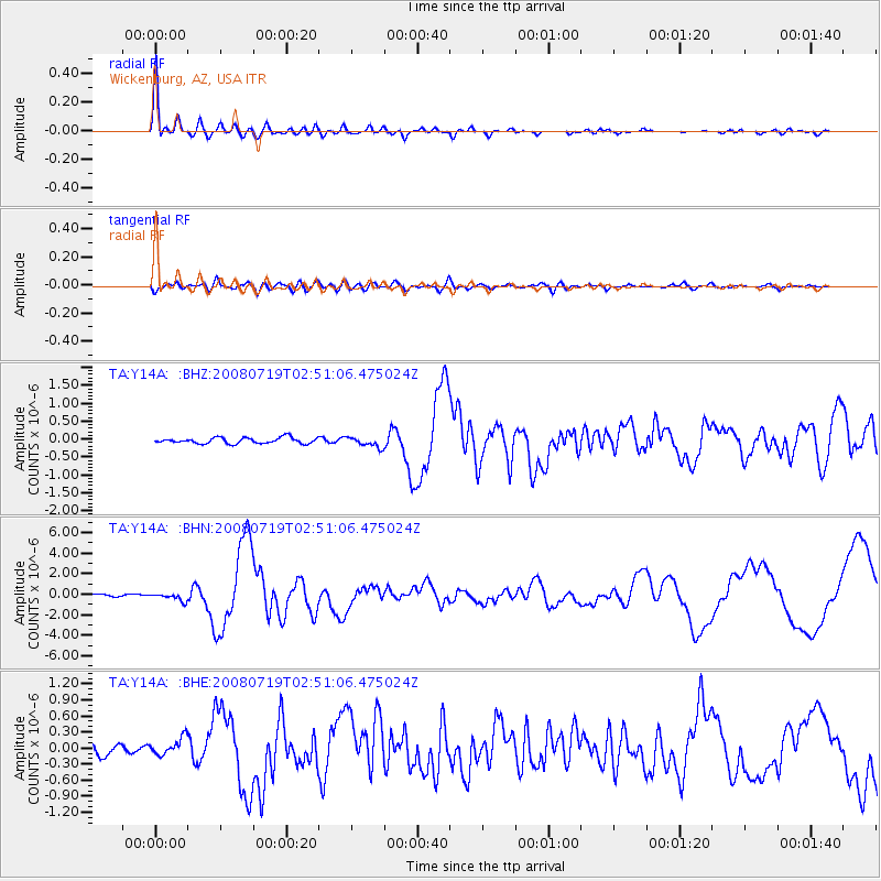
Signal To Noise
| Channel | StoN | STA | LTA |
| TA:Y14A: :BHN:20080719T02:51:06.475024Z | 3.5406852 | 3.5904753E-7 | 1.0140623E-7 |
| TA:Y14A: :BHE:20080719T02:51:06.475024Z | 2.164749 | 1.58695E-7 | 7.330873E-8 |
| TA:Y14A: :BHZ:20080719T02:51:06.475024Z | 1.7184091 | 1.3960661E-7 | 8.124178E-8 |
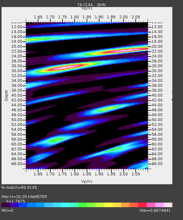
| Arrivals | |
| Ps | 3.6 SECOND |
| PpPs | 12 SECOND |
| PsPs/PpSs | 16 SECOND |

