
Y14A Wickenburg, AZ, USA - Earthquake Result Viewer
| ||||||||||||||||||
| ||||||||||||||||||
| ||||||||||||||||||
|
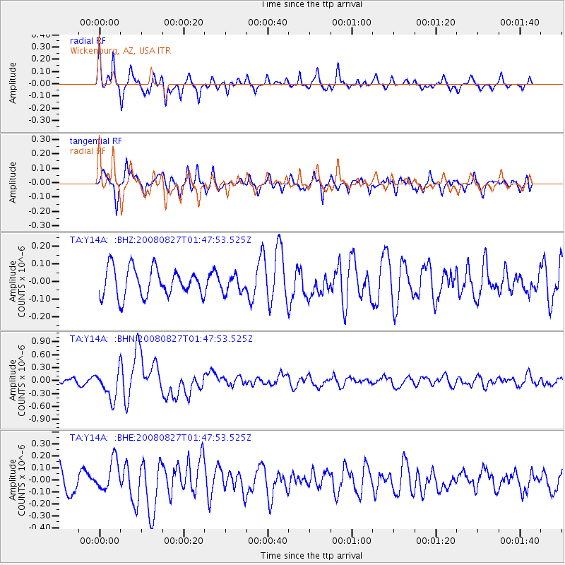
Signal To Noise
| Channel | StoN | STA | LTA |
| TA:Y14A: :BHN:20080827T01:47:53.525Z | 3.3559155 | 3.3503557E-7 | 9.9834324E-8 |
| TA:Y14A: :BHE:20080827T01:47:53.525Z | 1.3530674 | 1.3304746E-7 | 9.833026E-8 |
| TA:Y14A: :BHZ:20080827T01:47:53.525Z | 0.61881983 | 5.0057796E-8 | 8.089236E-8 |
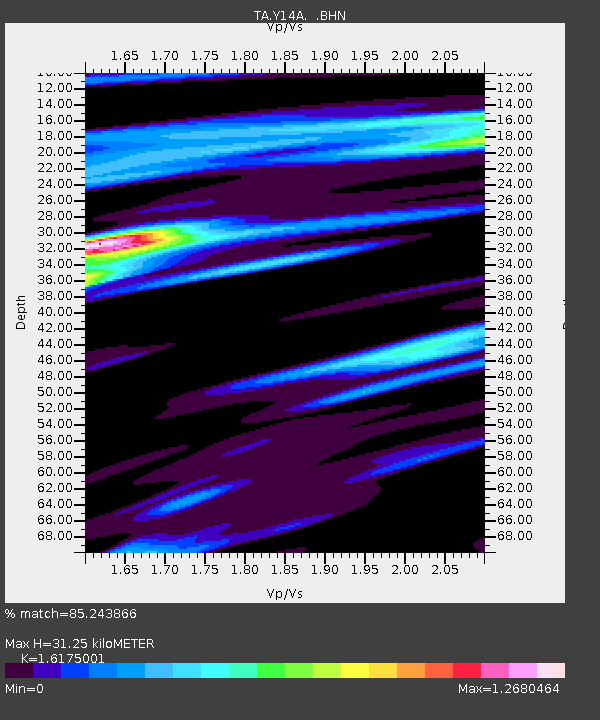
| Arrivals | |
| Ps | 3.2 SECOND |
| PpPs | 13 SECOND |
| PsPs/PpSs | 16 SECOND |

