You are here: Home > Network List > TA - USArray Transportable Network (new EarthScope stations) Stations List
> Station B18K Kokolik River, AK, USA > Earthquake Result Viewer
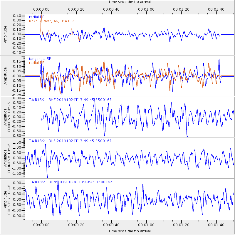
B18K Kokolik River, AK, USA - Earthquake Result Viewer
*The percent match for this event was below the threshold and hence no stack was calculated.
| Earthquake location: |
Minahassa Peninsula, Sulawesi |
| Earthquake latitude/longitude: |
1.1/124.2 |
| Earthquake time(UTC): |
2019/10/24 (297) 13:38:17 GMT |
| Earthquake Depth: |
250 km |
| Earthquake Magnitude: |
5.6 Mww |
| Earthquake Catalog/Contributor: |
NEIC PDE/us |
|
| Network: |
TA USArray Transportable Network (new EarthScope stations) |
| Station: |
B18K Kokolik River, AK, USA |
| Lat/Lon: |
69.36 N/161.80 W |
| Elevation: |
222 m |
|
| Distance: |
83.3 deg |
| Az: |
20.066 deg |
| Baz: |
255.39 deg |
| Ray Param: |
$rayparam |
*The percent match for this event was below the threshold and hence was not used in the summary stack. |
|
| Radial Match: |
46.16004 % |
| Radial Bump: |
400 |
| Transverse Match: |
49.247288 % |
| Transverse Bump: |
400 |
| SOD ConfigId: |
19951751 |
| Insert Time: |
2019-11-07 13:45:38.942 +0000 |
| GWidth: |
2.5 |
| Max Bumps: |
400 |
| Tol: |
0.001 |
|
Signal To Noise
| Channel | StoN | STA | LTA |
| TA:B18K: :BHZ:20191024T13:49:45.350016Z | 1.907928 | 8.508499E-7 | 4.4595495E-7 |
| TA:B18K: :BHN:20191024T13:49:45.350016Z | 0.8343547 | 2.3645305E-7 | 2.833963E-7 |
| TA:B18K: :BHE:20191024T13:49:45.350016Z | 1.4638805 | 3.7285625E-7 | 2.5470402E-7 |
| Arrivals |
| Ps | |
| PpPs | |
| PsPs/PpSs | |


