You are here: Home > Network List > CI - Caltech Regional Seismic Network Stations List
> Station MPM Manuel Prospect Mine, California, USA > Earthquake Result Viewer
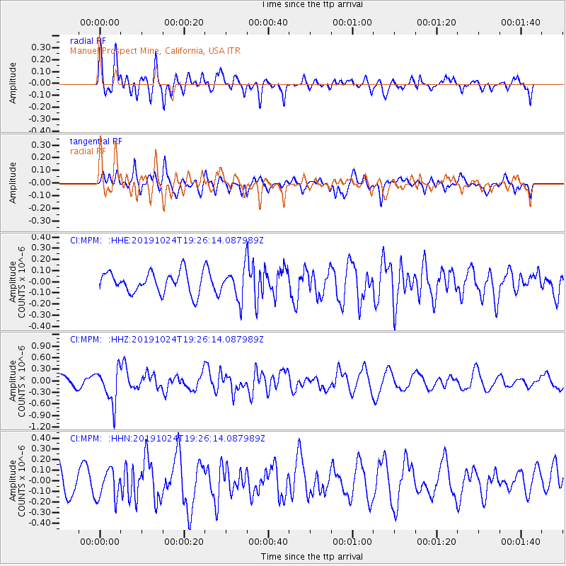
MPM Manuel Prospect Mine, California, USA - Earthquake Result Viewer
*The percent match for this event was below the threshold and hence no stack was calculated.
| Earthquake location: |
Kermadec Islands Region |
| Earthquake latitude/longitude: |
-28.6/-177.0 |
| Earthquake time(UTC): |
2019/10/24 (297) 19:14:17 GMT |
| Earthquake Depth: |
82 km |
| Earthquake Magnitude: |
5.6 Mww |
| Earthquake Catalog/Contributor: |
NEIC PDE/us |
|
| Network: |
CI Caltech Regional Seismic Network |
| Station: |
MPM Manuel Prospect Mine, California, USA |
| Lat/Lon: |
36.06 N/117.49 W |
| Elevation: |
185 m |
|
| Distance: |
85.3 deg |
| Az: |
44.477 deg |
| Baz: |
229.473 deg |
| Ray Param: |
$rayparam |
*The percent match for this event was below the threshold and hence was not used in the summary stack. |
|
| Radial Match: |
73.73424 % |
| Radial Bump: |
400 |
| Transverse Match: |
54.308422 % |
| Transverse Bump: |
400 |
| SOD ConfigId: |
19951751 |
| Insert Time: |
2019-11-07 19:18:37.107 +0000 |
| GWidth: |
2.5 |
| Max Bumps: |
400 |
| Tol: |
0.001 |
|
Signal To Noise
| Channel | StoN | STA | LTA |
| CI:MPM: :HHZ:20191024T19:26:14.087989Z | 2.1128697 | 4.575647E-7 | 2.1656079E-7 |
| CI:MPM: :HHN:20191024T19:26:14.087989Z | 0.9400816 | 1.400972E-7 | 1.4902663E-7 |
| CI:MPM: :HHE:20191024T19:26:14.087989Z | 1.503416 | 1.4071182E-7 | 9.359474E-8 |
| Arrivals |
| Ps | |
| PpPs | |
| PsPs/PpSs | |


