You are here: Home > Network List > TA - USArray Transportable Network (new EarthScope stations) Stations List
> Station Y14A Wickenburg, AZ, USA > Earthquake Result Viewer
Y14A Wickenburg, AZ, USA - Earthquake Result Viewer
| Earthquake location: |
Solomon Islands |
| Earthquake latitude/longitude: |
-7.3/155.6 |
| Earthquake time(UTC): |
2007/04/01 (091) 21:45:37 GMT |
| Earthquake Depth: |
10 km |
| Earthquake Magnitude: |
5.7 MB |
| Earthquake Catalog/Contributor: |
WHDF/NEIC |
|
| Network: |
TA USArray Transportable Network (new EarthScope stations) |
| Station: |
Y14A Wickenburg, AZ, USA |
| Lat/Lon: |
33.94 N/113.00 W |
| Elevation: |
731 m |
|
| Distance: |
95.2 deg |
| Az: |
56.565 deg |
| Baz: |
264.679 deg |
| Ray Param: |
0.040857553 |
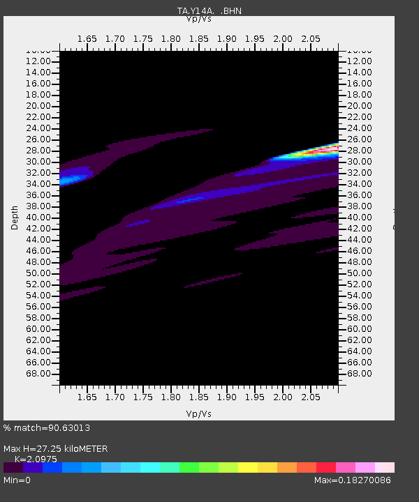
| Estimated Moho Depth: |
27.25 km |
| Estimated Crust Vp/Vs: |
2.10 |
| Assumed Crust Vp: |
6.264 km/s |
| Estimated Crust Vs: |
2.986 km/s |
| Estimated Crust Poisson's Ratio: |
0.35 |
|
| Radial Match: |
90.63013 % |
| Radial Bump: |
400 |
| Transverse Match: |
65.73634 % |
| Transverse Bump: |
350 |
| SOD ConfigId: |
2564 |
| Insert Time: |
2010-03-07 05:15:04.158 +0000 |
| GWidth: |
2.5 |
| Max Bumps: |
400 |
| Tol: |
0.001 |
|
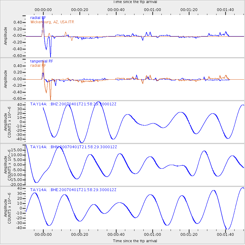
Signal To Noise
| Channel | StoN | STA | LTA |
| TA:Y14A: :BHN:20070401T21:58:29.300012Z | 0.66406983 | 7.123741E-6 | 1.0727397E-5 |
| TA:Y14A: :BHE:20070401T21:58:29.300012Z | 1.4310414 | 2.5706917E-5 | 1.7963783E-5 |
| TA:Y14A: :BHZ:20070401T21:58:29.300012Z | 1.522294 | 4.284927E-5 | 2.8147826E-5 |
| Arrivals |
| Ps | 4.9 SECOND |
| PpPs | 13 SECOND |
| PsPs/PpSs | 18 SECOND |


