You are here: Home > Network List > UW - Pacific Northwest Regional Seismic Network Stations List
> Station LEBA Lebam, WA, USA > Earthquake Result Viewer
LEBA Lebam, WA, USA - Earthquake Result Viewer
*The percent match for this event was below the threshold and hence no stack was calculated.
| Earthquake location: |
Kermadec Islands Region |
| Earthquake latitude/longitude: |
-28.6/-177.0 |
| Earthquake time(UTC): |
2019/10/24 (297) 19:14:17 GMT |
| Earthquake Depth: |
82 km |
| Earthquake Magnitude: |
5.6 Mww |
| Earthquake Catalog/Contributor: |
NEIC PDE/us |
|
| Network: |
UW Pacific Northwest Regional Seismic Network |
| Station: |
LEBA Lebam, WA, USA |
| Lat/Lon: |
46.55 N/123.56 W |
| Elevation: |
73 m |
|
| Distance: |
89.1 deg |
| Az: |
33.673 deg |
| Baz: |
224.925 deg |
| Ray Param: |
$rayparam |
*The percent match for this event was below the threshold and hence was not used in the summary stack. |
|
| Radial Match: |
61.54842 % |
| Radial Bump: |
400 |
| Transverse Match: |
41.62584 % |
| Transverse Bump: |
400 |
| SOD ConfigId: |
19951751 |
| Insert Time: |
2019-11-07 19:23:02.829 +0000 |
| GWidth: |
2.5 |
| Max Bumps: |
400 |
| Tol: |
0.001 |
|
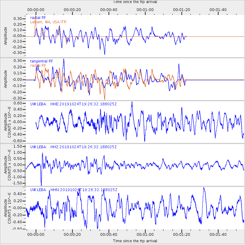
Signal To Noise
| Channel | StoN | STA | LTA |
| UW:LEBA: :HHZ:20191024T19:26:32.188025Z | 2.7914584 | 4.859552E-7 | 1.740865E-7 |
| UW:LEBA: :HHN:20191024T19:26:32.188025Z | 0.99005306 | 1.4120421E-7 | 1.4262287E-7 |
| UW:LEBA: :HHE:20191024T19:26:32.188025Z | 0.88705164 | 1.371815E-7 | 1.5464884E-7 |
| Arrivals |
| Ps | |
| PpPs | |
| PsPs/PpSs | |


