You are here: Home > Network List > IU - Global Seismograph Network (GSN - IRIS/USGS) Stations List
> Station PMG Port Moresby, New Guinea > Earthquake Result Viewer
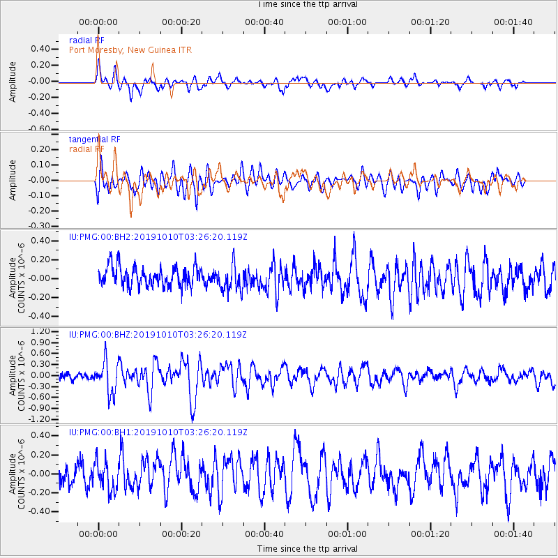
PMG Port Moresby, New Guinea - Earthquake Result Viewer
*The percent match for this event was below the threshold and hence no stack was calculated.
| Earthquake location: |
Macquarie Island Region |
| Earthquake latitude/longitude: |
-58.0/157.4 |
| Earthquake time(UTC): |
2019/10/10 (283) 03:18:03 GMT |
| Earthquake Depth: |
10 km |
| Earthquake Magnitude: |
5.6 Mww |
| Earthquake Catalog/Contributor: |
NEIC PDE/us |
|
| Network: |
IU Global Seismograph Network (GSN - IRIS/USGS) |
| Station: |
PMG Port Moresby, New Guinea |
| Lat/Lon: |
9.40 S/147.16 E |
| Elevation: |
90 m |
|
| Distance: |
49.1 deg |
| Az: |
346.605 deg |
| Baz: |
172.81 deg |
| Ray Param: |
$rayparam |
*The percent match for this event was below the threshold and hence was not used in the summary stack. |
|
| Radial Match: |
69.06294 % |
| Radial Bump: |
400 |
| Transverse Match: |
65.232185 % |
| Transverse Bump: |
400 |
| SOD ConfigId: |
19951751 |
| Insert Time: |
2019-11-08 00:37:46.741 +0000 |
| GWidth: |
2.5 |
| Max Bumps: |
400 |
| Tol: |
0.001 |
|
Signal To Noise
| Channel | StoN | STA | LTA |
| IU:PMG:00:BHZ:20191010T03:26:20.119Z | 5.027164 | 4.5510225E-7 | 9.052862E-8 |
| IU:PMG:00:BH1:20191010T03:26:20.119Z | 1.5870552 | 1.5503853E-7 | 9.768944E-8 |
| IU:PMG:00:BH2:20191010T03:26:20.119Z | 1.4453905 | 1.4631514E-7 | 1.0122879E-7 |
| Arrivals |
| Ps | |
| PpPs | |
| PsPs/PpSs | |


