You are here: Home > Network List > US - United States National Seismic Network Stations List
> Station LONY Lake Ozonia, New York, USA > Earthquake Result Viewer
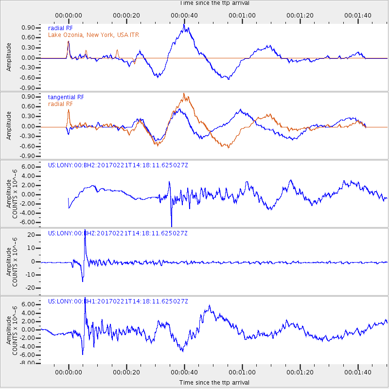
LONY Lake Ozonia, New York, USA - Earthquake Result Viewer
*The percent match for this event was below the threshold and hence no stack was calculated.
| Earthquake location: |
Southern Bolivia |
| Earthquake latitude/longitude: |
-19.3/-63.9 |
| Earthquake time(UTC): |
2017/02/21 (052) 14:09:04 GMT |
| Earthquake Depth: |
598 km |
| Earthquake Magnitude: |
6.5 Mww |
| Earthquake Catalog/Contributor: |
NEIC PDE/us |
|
| Network: |
US United States National Seismic Network |
| Station: |
LONY Lake Ozonia, New York, USA |
| Lat/Lon: |
44.62 N/74.58 W |
| Elevation: |
440 m |
|
| Distance: |
64.3 deg |
| Az: |
351.554 deg |
| Baz: |
168.797 deg |
| Ray Param: |
$rayparam |
*The percent match for this event was below the threshold and hence was not used in the summary stack. |
|
| Radial Match: |
62.95259 % |
| Radial Bump: |
400 |
| Transverse Match: |
58.92543 % |
| Transverse Bump: |
400 |
| SOD ConfigId: |
1992691 |
| Insert Time: |
2017-03-07 14:16:25.951 +0000 |
| GWidth: |
2.5 |
| Max Bumps: |
400 |
| Tol: |
0.001 |
|
Signal To Noise
| Channel | StoN | STA | LTA |
| US:LONY:00:BHZ:20170221T14:18:11.625027Z | 20.466179 | 3.4640175E-6 | 1.692557E-7 |
| US:LONY:00:BH1:20170221T14:18:11.625027Z | 0.6945131 | 1.4418088E-6 | 2.0759994E-6 |
| US:LONY:00:BH2:20170221T14:18:11.625027Z | 1.0043128 | 1.0900875E-6 | 1.0854064E-6 |
| Arrivals |
| Ps | |
| PpPs | |
| PsPs/PpSs | |


