You are here: Home > Network List > US - United States National Seismic Network Stations List
> Station MNTX Cornudas Mountains, Texas, USA > Earthquake Result Viewer
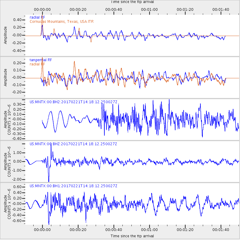
MNTX Cornudas Mountains, Texas, USA - Earthquake Result Viewer
*The percent match for this event was below the threshold and hence no stack was calculated.
| Earthquake location: |
Southern Bolivia |
| Earthquake latitude/longitude: |
-19.3/-63.9 |
| Earthquake time(UTC): |
2017/02/21 (052) 14:09:04 GMT |
| Earthquake Depth: |
598 km |
| Earthquake Magnitude: |
6.5 Mww |
| Earthquake Catalog/Contributor: |
NEIC PDE/us |
|
| Network: |
US United States National Seismic Network |
| Station: |
MNTX Cornudas Mountains, Texas, USA |
| Lat/Lon: |
31.70 N/105.38 W |
| Elevation: |
404 m |
|
| Distance: |
64.4 deg |
| Az: |
321.251 deg |
| Baz: |
136.085 deg |
| Ray Param: |
$rayparam |
*The percent match for this event was below the threshold and hence was not used in the summary stack. |
|
| Radial Match: |
63.885136 % |
| Radial Bump: |
400 |
| Transverse Match: |
67.42123 % |
| Transverse Bump: |
400 |
| SOD ConfigId: |
1992691 |
| Insert Time: |
2017-03-07 14:16:32.289 +0000 |
| GWidth: |
2.5 |
| Max Bumps: |
400 |
| Tol: |
0.001 |
|
Signal To Noise
| Channel | StoN | STA | LTA |
| US:MNTX:00:BHZ:20170221T14:18:12.250027Z | 4.8563027 | 7.6026987E-7 | 1.5655323E-7 |
| US:MNTX:00:BH1:20170221T14:18:12.250027Z | 3.603845 | 2.7302644E-7 | 7.5759765E-8 |
| US:MNTX:00:BH2:20170221T14:18:12.250027Z | 1.2496134 | 1.3235405E-7 | 1.05915994E-7 |
| Arrivals |
| Ps | |
| PpPs | |
| PsPs/PpSs | |


